


Custom Search
|
October 25th, 2010---: Oh well. Richard fizzled over Central America and with that comes what most likely is the end of the season as far as chasing is concerned. Thus begins the long wait until spring 2011. I'll be back in a few months, unless something unexpected pops up in the meantime! And in the meantime, my NYC weather blog will be updated on a regular basis so be sure to check in there.
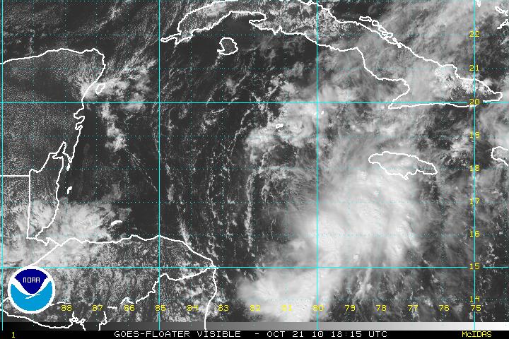
October 21st, 2010---: Well, barely three weeks into my fall and winter hiatus and I'm back with what could be a late season chase! Tropical Storm Richard has formed in the Caribbean this morning, and while it's a long shot, Richard does pose a threat to the US next week. Several of the reliable models are forecasting Richard to strengthen and then turn into a weakness in the ridge of high pressure that will be positioned over the Gulf and Southeast states. The key to all of this however will be how strong the ridge of high pressure is come next week. If the ridge is very strong, then Richard will most likely bury himself into the Yucatan. But, if the ridge is weaker, than he could take a very Wilma 2005 type track and hit the SW coast of Florida. Lots can and will still happen but it's time to dust off the gear just in case it all comes together! More updates to follow!
October 3rd, 2010---: It's getting to that time again when I have to lay this blog to rest until next spring when we once again start gearing up for storm chase 2011! Until that time, I will be updating my NYC Weather Blog on a regular basis, so check in there for the latest. However, there is still some time left to this hurricane season, so if something pops up....I will resurrect this page, if not...then we'll see you in the spring!
September 19th, 2010---: Got a few still photos up in the "New Photos" section of my photo gallery. Check them out! Also, I will be doing an interview tomorrow with the Queens Chronicle newspaper about my personal experience with the storm. If you haven't checked out the video that I've posted yet, you can visit my YouTube Channel (the link is on my main page), or you can bounce over to the "Latest Video Uploads" section right here to view the 6 minute clip. The clean up process continues today, but at least the weather is beautiful. Pretty much a classic early fall day here.
September 18th, 2010---: In the 25 years that I have been documenting storms out of my neighborhood here in Queens, NY I have never witnessed, nor documented a storm like this! On the evening of September 16th a line of storms slammed into Queens and Brooklyn and completely tore up my neighborhood of Middle Village and Rego Park. Cecelia and I were finishing up dinner when I started hearing thunder in the distance. Nothing out of the ordinary there. So, I didn't think much of it and I sat by my window and watched as the storm approached. What struck me though was about 5 minutes before it hit, the power started flickering...this peaked my interest enough that I now consider grabbing my camera and heading onto the porch. In all fairness, I have to give the credit to my girlfriend Cecelia for saying "hey, let's go out and watch this". So, I grabbed my video camera and we set up on our porch. Literally about a minute later was when all hell broke loose! The storm hit with a ferocity that I have never seen here before. And the damage was incredible! We'll be cleaning up for weeks for sure, and I'm still in the process of documenting the after math. I have posted a six minute video showing the storm as it hit, followed by the immediate aftermath! You can view the video on my YouTube channel (the link is on the main page) or you can click on the "latest video uploads" button to the left to view.
September 6th, 2010---: Dave Lewison and I intercepted Hurricane Earl on Cape Cod this past Friday, and while Earl didn't exactly pack a punch by the time he got up this way, he did still put on a good show for us regardless. Too bad though it was literally in the middle of the night by the time he got to us! Still though, prior to the sun going down we did get to see some rough surf and strong winds as the outer bands of Earl made their way onshore. I've posted a three minute highlights video on my YouTube Channel, which can also be found here on the website under the "Latest Video Uploads" tab. Check it out!!
September 2nd, 2010---: Hurricane Earl is beginning to lose some of his punch late this afternoon as he approaches the outer banks of North Carolina, but Dave and I are hoping he sustains enough of it to give the Cape Cod area some interesting weather tomorrow night! The plan that's in place right now is for me to depart NYC at 5:30am tomorrow at which point I'll head up to Dave's place in Wappingers Falls, NY. Once there I'll pick up Dave and Stephanie and we'll head out to the Cape. All in all is about a 6 hour drive, and we could very well come home empty handed if Earl decides to shift further east, or weaken substantially before getting there. But, we figured it's worth the risk and we're going to roll the dice on this one. This is the first hurricane to really threaten the east coast of the US since Hurricane Bob in August of 1991. I was just 19 years old at the time, and it could be another 19 or more years before it happens again. So, we'll go for it and will get what we get! More updates will follow once I'm home on Sunday. You can always get more up to date info on my Facebook page if you're interested! The link to it is on the main page.
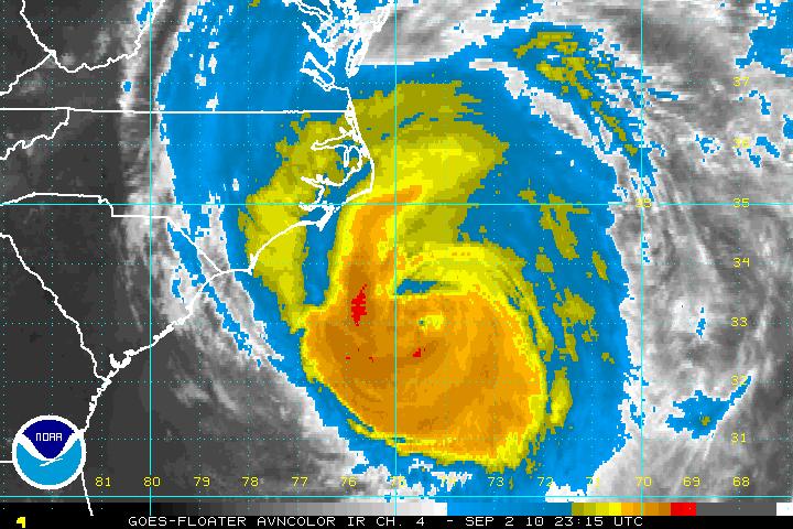
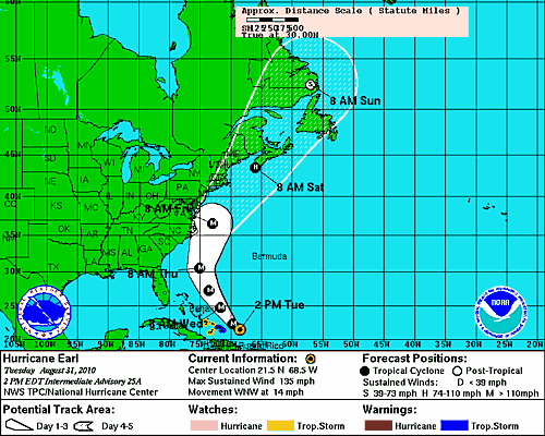
August 31st, 2010---: Hurricane Earl is now a dangerous Category Four storm and after giving the northern Lesser Antilles a whack yesterday, along with Puerto Rico, he's moved on off to the northwest at a forward speed of about 14 mph. The track forecast for Earl is tricky since any slight deviation means big consequences to folks from the mid Atlantic into the northeast. Right now at least it appears that the center of Earl will remain off shore, but it does appear that he'll get pretty close to the outer banks of North Carolina, as well as Cape Cod, MA and perhaps even eastern Long Island. I'll be keeping a watchful eye on things over the next day or two and an intercept either on Long Island, or Cape Cod is a strong possibility. Below is the latest NHC track for Hurricane Earl as of 11am this morning. More updates to come!!
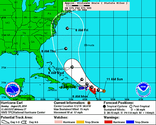
August 29th, 2010---: Things are certainly getting interesting in the tropics. Just over a week ago nothing much was going on and now we have two hurricanes roaming the Atlantic, and one possible depression forming. WOW, just goes to show you how fast things can change this time of year. So, after digesting the models for the past few days it appears that for the first time in a very long time, the northeast US is looking at a very real threat from Hurricane Earl. Earl has just been upgraded to hurricane status as of 11am this morning and will brush the northern Leeward Islands over the next day or so. After that, the forecast track has Earl bending towards the northwest, and eventually to the north around the western edge of a ridge of high pressure in the Atlantic. On this path, it is very possible that Earl could ride just off shore up the east coast and eventually *could* make land fall either in my area, or perhaps northeast of here around the Cape Cod area. It's still way too early to begin speculating on all of this but the signs are there there we need to keep a watchful eye over the coming week. After Earl, some of the models are suggesting that what could turn out to be Fiona may pose a threat to the SE coast of the US. Needless to say, it's going to be a very busy week ahead for me! More updates to follow! Below is the current official track forecast from the National Hurricane Center for Hurricane Earl.
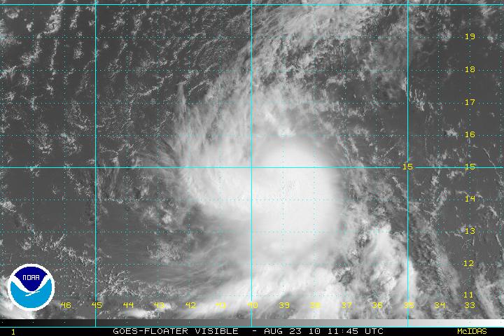
August 23rd, 2010---: The tropics seem to finally be heating up and only time will tell if we'll end up having a "hyper-active" season as predicted. My gut is telling me that no, it won't be an insane season, but there is still plenty of time to see some big storms out there, and things have finally started to heat up. Tropical Storm Danielle has formed in the central/eastern Atlantic and as of this morning, is looking really good! Danielle for the time being isn't a threat to any land areas, with the exception of maybe Bermuda down the road but there's plenty of time to watch her. All of the model guidance is taking Danielle out to sea in a few days due to a weakness in the ridge of high pressure located over the Atlantic. But, the models are also forecasting a strong ridge of high pressure to begin building in next week and this could mean that if anything forms behind Danielle, it could be steered much farther to the west. Speaking of, there is an area of interest just off the west African coast that needs to be monitored. Regardless of track, Danielle is forecast to become a formidable hurricane in a few days, and it will be nice to finally have something to track! Check back soon as I'll be posting more updates as the week goes on. Below is a satellite image of Danielle taking just a short while ago, looking good!
August 15th, 2010---: The tropics are beginning to heat up and by this time next week we could be tracking several storms in the Atlantic! Nothing has formed yet, but all of the reliable models are, and have been forecasting development off the coast of Africa. There are several waves still over mainland Africa that are already showing a nice spin to them so I think things will start getting interesting soon. It's still way too early to tell whether any of these potential storms will ultimately make land fall in the US, first we have to see if they actually form first...but if the models hold true, and there are several storms roaming the tropical Atlantic next week, then things will have to be monitored closely for sure! Stay tuned...
August 4th, 2010---: I've just returned from a successful trip to South Florida where I not only got in some R&R with my girlfriend Ceceila, but also came home with some great storm video! Just getting back up to speed here but I've uploaded my latest videos to my YouTube Channel, as well as here on my website in the "Latest Video Uploads" page. Check em' out!
July 28th, 2010---: Cecelia and I will be vacationing in the Fort Lauderdale area over the next week and while the chance for storms doesn't look all that great, I will be on the lookout regardless and plan to document, and possibly live stream any storms we experience! We picked a quiet time in the tropics to take this vacation, good timing on our part. I have the feeling the quiet times won't last much longer.
July 23rd, 2010---: Tropical Storm Bonnie made land fall earlier today in Miami/Dade County but there wasn't much fan fare associated with Bonnie when she came ashore. Bonnie was barely a tropical storm and wasn't worth the expense to go after. Not to mention the fact that I would have had to cancel our vacation to Ft Lauderdale which is scheduled for this upcoming Wednesday. Ironically enough, if Bonnie would have waited a week, Cecelia and I would have been there for land fall, or what there was of it. This could be a sign of things to come however as there is some correlation between tracks of July/early August storms, and storms later in the heart of the season. It's not uncommon to have several storms follow similar tracks so things could get interesting as we get further into this hurricane season.
July 9th, 2010---: It's only early July and we've already seen two systems take shape in the Atlantic! The first storm back in late June/early July was Hurricane Alex, and Tropical Depression Two took shape yesterday just prior to making land fall in extreme south Texas. A sign of things to come? Well, it's possible but we'll just have to wait and see. Right now I have a storm photography trip planned for the end of the month. I'll be traveling down to Ft Lauderdale for a week in the hopes of adding to my lightning archives. South Florida offers up some amazing lightning displays and hopefully nature won't disappoint while I'm there! I will have to postpone however if a hurricane threatens, but I'll cross that bridge if and when I come to it.
July 6th, 2010---: The tropical Atlantic remains active and we have another area of interest which has been designated Invest 96L. The Hurricane Center has given 96L a 30% chance of developing into a tropical cyclone, and it's track is very close to the path that Alex took just a week ago! Most of the reliable computer models don't develop 96L into a formidable storm, but it bears watching regardless. Below is a satellite shot of 96L taken earlier this afternoon.
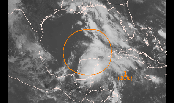
June 30th, 2010---: Hurricane Alex, the first June hurricane in the Atlantic since the 2005 hurricane season is getting better organized this morning, and will make land fall south of the Texas border in northeast Mexico later tonight. Alex took a long time to get his act together, but he's finally attained hurricane status and is sure to bring strong winds and torrential flooding rains to rural Mexico later this evening and tonight. I've decided against going after Alex for several reasons. But the main reasons are that he's not that strong, and wouldn't be worth the 2000 mile journey to intercept. Plus, I'm not a big fan of chasing in rural Mexico, lol. This is just the start to what could be a very active hurricane season in the Atlantic. I'll be keeping a close eye on things over the coming months and this page will be updated often so be sure to check back.
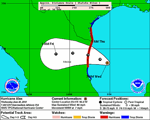
June 26th, 2010---: Hurricane Alex forms in the western Caribbean sea! The first named storm of the 2010 hurricane season has formed and right now, the track has him staying at tropical storm strength as he moves over the Yucatan Peninsula in a day or so. After that, Alex is forecast to head towards the TX/Mexico border. Not anticipating an intercept at this time, but will monitor the situation for sure! In news closer to home, I may be out chasing this coming Monday in either Connecticut, or possibly closer to home (NYC/Long Island). As it stands right now, it could be another interesting day severe weather wise! Still too early for an exact target but will fine tune over the next 48 hours. If I chase, I will be live streaming so be sure to check back for updates!
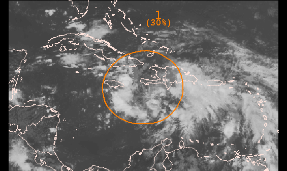
June 23rd, 2010---: It's only late June but here we are watching an area of storms down in the Caribbean which has been designated invest 93L! An invest is the stage before an area of storms is categorized a tropical depression. Even though it's early in the season, conditions are favorable ahead of 93L, and a tropical depression could form over the next few days. Some of the forecast models take 93L towards the Gulf Of Mexico this weekend. Below is a picture of 93L taken just a short while ago. Still very disorganized for the time being, but I'll be keeping a close eye.
June 21st, 2010---: While gearing up for the upcoming hurricane season, I took some time and finally posted some photos to my New Photos page of my May 2010 storm chase trip to the plains! Put your cursor over the "Photo Gallery" link on the left side navigation bar and then choose "new photos" to be taken to the page.
June 10th, 2010---: All is quiet on the chasing front for me at least, but storms are still plentiful out on the plains. Wish I could be there to chase but unless there is a windfall of cash, or I win the lottery..chasing every good set up won't be in the cards. Next season however Dave and I are anticipating chasing for 3 plus weeks so that's definitely something to look forward to! I do however have the upcoming hurricane season to look forward too, and this season I will be on just about every land falling hurricane! I'll assess each event as they come along, but if the latest NWS/NOAA forecasts even come close to verifying, the 2010 hurricane season will be a doozy! Time will tell, but as of right now we still have several weeks until things should start heating up.
June 1st, 2010---: Our 2010 storm chase trip ended last week and we ended up seeing a lot of great storms this year once again. We did miss a few big tornadoes in South Dakota, but hey..you can't win them all, and we'll have another crack at it next year. Be sure to check out my "latest video uploads" section for some of my recent videos! I'll also be posting them on my YouTube channel so be sure to subscribe to that as well! Now my thoughts will turn to this hurricane season! It starts today!
May 25th, 2010---:Well my 2010 storm chasing trip is coming to a close. After 18 days on the road, we'll be taking the final jaunt back to NYC from our current location of Indianapolis. We drove over 900 miles yesterday and have a good 13 hour drive ahead of us today so it'll be a long one. Unfortunatley we missed out on some very photogenic tornadoes yesterday in South Dakota again, but with our time constraints....we had to be back. It stinks, but that's life for you. And there will be other storm chases and more tornadoes to see so all will be good. Plus, this trip was a success despite missing some big ones yesterday. I saw 5 tornadoes total, tons of amazing storms, incredible storm structure, large hail, and a few great lightning displays. Photos and videos will be posted upon my return to NYC. Just need a few days to get settled and then I'll get em' up on my website, and my YouTube Channel! Be sure to check back next week!
May 22nd, 2010---:We had our first true blue sky bust in NE Colorado yesterday...got nothing but a slight sunburn, lol. It happens at least once or twice on any given storm chase trip and yesterday was our day. Today there is the chance of storms in northern Nebraksa and southern South Dakota so we'll be heading there today. Right now we're in Ogallala, NE packing up our gear and getting ready for yet another chase. Chase 2010 is coming to a close and we'll be parting ways with Mark Robinson this afternoon. Mark had a great group of chasers with him this year and we'll definitely miss their company big time. A ton of fun was had over the last two weeks!! Dave and I will be chasing tomorrow and Monday, and after Monday's chase is completed we'll start heading back to NYC. Hopefully we'll witness more amazing storms before our trip comes to a close!
May 19th, 2010---:The past two days have been great! Yesterday we chased an amazing tornadic supercell near Dalhart/Dumas, TX and we witnessed and documented a beautiful tornado. It was a few miles away, but that's ok....it was incredible none the less! Then today we witnessed two tornadoes near Stillwater, OK. The first tornado was about 5 miles away but we could see the debris swirl on the ground, and the second tornado touched down as we approached the town on Stillwater. We pulled off the road right as it was forming about 1/2 mile away. The funnel never fully condensed all the way to the ground, but a debris swirl was very evident at the surface, and I shot great video of it. After that, we were treated to some amazing storm structure and a few close calls with very large hail!! The road network didn't really cooperate with us today and we found ourselves in some pretty hairy situations. Most notable was when we had to make a quick decision on whether to take an east road which would most likely turn to dirt (but would get us out of the direct path of the approaching core faster), or shoot south and punch through the hook. We chose the hook since getting stuck on a muddy dirt road would have been very bad to say the least.Problem was, the storm wrapped back up as we were punching through the hook and the next thing I knew, we were slamming on the brakes and pulling off the road due to intense RFD screaming across the road! Actually, there's was some talk tonight that the outer circulation of a tornado passed right in front of us, but this wasn't confirmed. A house just off the road from where we pulled off started losing it's shingles and a piece of their overhang. It was a scary moment for us but thankfully we got out of there all right. Not sure if we'll be chasing tomorrow just yet. It may be a down day.
May 17th, 2010---:We had a much needed down day today and took advantage of it by getting some laundry done, getting an oil change for my Xterra (along with new wiper blades) and we even took in a movie! Iron Man 2! Tomorrow we'll be back in chase mode and will most likely be heading to the west/northwest TX Panhandle. Intense supercells are possible there tomorrow afternoon and evening, this assuming that overnight convection doesn't screw up the works! Fingers crossed!
May 16th, 2010---:At first it appeared as if Dave and I were going to head home early, but wow how things can change quickly here in Tornado Alley. Now things are looking quite good for this coming Tuesday and Wednesday in the Texas Panhandle, so yes....we've decided to stick around. Actually, we'll most likely be sticking around for about another 9 days! Several of the reliable models are bringing in another trough come this weekend and we don't want to miss it!! Fingers crossed that this trough materializes. More on that to come tomorrow. Now on to today! We initially thought today was going to be a travel day to Oklahoma City where we'd just relax and prepare for Tuesday and Wednesday's chase. Boy were we wrong!! A storm went up just northwest of OKC and we intercepted this cell near the town of Forest Park. We got nailed with an 11 minute golf ball hail barrage and it definitely ranks up there with some of the best hail footage I've ever captured on video! I'll post video upon my return to NYC in about 10 days. Tomorrow is a down day so we'll do laundry, and I'll also get an oil change for my Xterra. We've driven about 3500 miles since my last one so I'm due.
May 13th, 2010---:Currently in Elk City, OK. Well the past two days overall haven't been too eventful, but we did manage to get on some nice storms in Northwest Oklahoma yesterday. The storms that we were on didn't produce any tornadoes, but we did manage to film a nice lightning display at the end of the day so all was not lost. Tomorrow is looking to be a down day which is fine by us. I unfortunatley blew a tire while on a dirt road yesterday and we had to put the spare on there. Can't chase without a spare so we'll have to find a place in Elk City tomorrow to purchase a new tire. After we're done with that we may relocate to Amarillo, TX to set up for some possible storms on Friday! Fingers crossed that verifies.
May 11th, 2010---: TORNADO! Actually, we witnessed and documented two short lived tornadoes yesterday afternoon west of the town of Medford, OK. SPC had a high risk out for tornadoes and severe weather in general yesterday and it certainly verified. We stayed in Blackwell, OK the night before and we couldn't have picked a better location. Storms went up just to our west and the first storm we intercepted near the town of Nash quickly produced a tornado. The first tornado was a slender elepahnt trunk which touched down for about two minutes. Once it lifted we knew that we had to reposition due to the extremly fast storm motions yesterday. Storms were moving around 55 mph!! We adjusted our location and could see what was now a wedge in the making taking shape right behind our vehicles! We jumped out and the first thing I saw was this amazing Merry-Go-Round meso rotating practically right above us, a awe inspiring sight indeed. I shot about 30 seconds of video but missed the part earlier where several subvorticies were touching down behind us. So of the others with me did get this on video. It was insane!! We continued down the road and attempted another intercept, but the storm was moving too fast for us to catch it. We opted for a more southern storm but that storm proved too hard to intercept as well. Overall though a successful day of chasing! We're here in Norman, OK currently which was hit by a strong tornado yesterday evening. Unfortunately I am hearing reports of a few fatalities and many injuries. This is something we never like to hear. Today we will be chasing in Oklahoma again it appears. More updates to follow, and video/pictures will be posted as soon as possible! You can keep tabs on us today by clicking on my "live tracking" link to the left.
May 9th, 2010---: What a long day yesterday was! Dave and I made it all the way to Washington, PA the first night which was a good 400 mile drive, and then yesterday we had the really long haul of about 800 miles from Washington, PA to Springfield, MO! We met up with our friend Mark Robinson in Illinois and now we're gearing up for what could be an active day tomorrow. Today will be a travel day to get into position for storms tomorrow. There's isn't much of a rush today which is nice so we'll head out of our hotel in about an hour or so and will slowly head westbound towards north/central Oklahoma or south/central Kansas. More updates to come!
May 7th, 2010---: Storm Chase 2010 is here! Lots to do before I leave here at 3pm so a quick update for now. I'll be heading up to Larchmont, NY in Westchester County to meet up with Dave Lewison at his parents house. From there, we'll pack up the truck and head westbound through Pennsylvania where we'll stop for the night about 15 miles from the West Virginia border in the town of Washington, PA. Tomorrow.....the long haul! We'll try to make it to Topeka, KS by nighfall.
May 6th, 2010---: All right! If things keep panning out it appears that our 2010 storm chase trip will begin tomorrow evening! Dave and I will make the final decision tomorrow morning, yeah I know....talk about waiting until the last minute. Right now it appears that this coming Sunday and Monday things could start picking up big time out on the plains! Actually, on paper, Monday looks like a full blown tornado outbreak. However, nothing is written in stone of course. Ok, so we know there will probably be a few interesting days of chasing early next week, but what about after that. Well there in lies the stressful part of things. There's no way to really know what will happen 9 or 10 days out, but it appears that the models are hinting at another trough moving into the west which could bring more chase opportunities towards the following weekend. Since we only have a limited amount of time on the road every year, Dave and I try our best to choose carefully which set ups to go after. The decision is never easy, and we don't always get it right either. Right now though things look good enough to pull the trigger on the trip, but hopefully this early week set up doesn't end up being a one shot deal. The drive will be long, we'd need to be in western Kansas or possibly the TX Panhandle by Sunday! Yeah, that's a lot of real estate to cover. If all goes to plan we'll meet up at Dave's parents house tomorrow evening and will head to Washington, PA where we'll stop for the night. More to come once things become clearer!
April 29th, 2010---: Our 2010 storm chase preps have been completed and now the waiting game begins. We're good to go anytime from next weekend onward so from here on out, Dave and I will be keeping daily tabs on the models. For the time being, next week looks relatively quiet, with the exception of some possible big storms today, and a very widespread severe weather threat tomorrow. After that however, things look to quiet down for about a week. How long with the lull last is anyone's guess, but we'll be watching for sure. Video of the final installment of our chase 2010 preps is now up on my YouTube channel, and I have also posted the video on my "latest video uploads" page, so be sure to check it out! Prior to completing our vehicle preps this past Saturday, Dave and I were interviewed by NBC for an upcoming show about storms to be aired on The Weather Channel later this spring. The interviews went great and after those were completed, it was off to Westchester County, NY where we finished up the vehicle preps. Needless to say, it was a very busy day!
April 16th, 2010---: Today I wired up the new Wilson cell phone amplifier in my Xterra. This cell phone amplifier should help us stay connected while in some of the more rural areas out on the plains this chase season. Many times we'd lose our data stream due to weak signals and hopefully, this new cell amp will minimize those times. And, right as I was finishing that project up, the Fed Ex guy showed up with the rest of the parts we needed for our new laptop desk!! I've put those on the side and we'll install that when Dave and I get together for Chase Preps (Phase Two) in about a week. It won't be long now until we hit the road for Chase 2010! Speaking of....this weekend will feature a preview of sorts when Dave and I meet up with fellow Canadian storm chaser George Kourounis in Manhattan. George is coming to town to do an interview with the History Channel and will have Sunday free. So we'll be getting together to hang out for a bit, talk shop, and have a few laughs. Really looking forward to it!
April 6th, 2010---: The trip to Albany, NY went great this past Saturday and we accomplished our goal of fabricating the base for our new laptop desk! Actually, as it turns out, we were able to use the pre-made base that I purchased a month ago. That base was made for the 2005 or 2006 Xterra, but not the 2004 which is what I own. Figures right? lol. But, after some grinding, welding and hammering by our good friend Marc, it's now installed!! Next up...order the rest of the parts we need to complete the laptop desk. And that's exactly what I will be doing later today. Our next get together will be the weekend of the 24th. During that get together Dave and I will be installing the windshield hail guard, as well as putting together and testing our new laptop desk. Photos will be posted!! In the meantime, if you'd like to see a 6 minute video of "Phase One" of our chase vehicle preparations, filmed up in Albany, NY this past weekend, click on the "latest video uploads" tab to the left to be redirected to the video page!
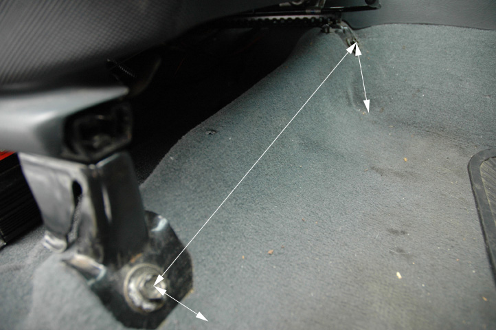
March 29th, 2010---: Dave and I will be heading up to Albany, NY this coming Saturday, April 3rd to start work on fabricating a base for our laptop desk. The ones they sell in the stores just don't cut it. Basically, they do not make a laptop desk base for the 2004 Xterra. No worries though, with Dave and our friend Marc on the job (both of them being engineers) we'll be able to fabricate something no doubt this weekend! Basically all we need to fabricate is a base that will attach to the seat rails on the passenger side, the rest of the assembly we can purchase from Ram Mount. Be sure to check back after the weekend as I'll be posting video of the fabrication process! It won't be long now until Dave and I are hitting the road for storm chase 2010! Perhaps as little as 4 or 5 weeks from now. Below is a picture of the seat rails/bolts in my Nissan Xterra that our laptop base will be attached to.
March 24th, 2010---: The trip down the Florida Keys for the annual chaser BBQ at Jim Leonard's place went off without a hitch! A great time was had by all who attended, and to cap things off, we even had a line of severe thunderstorms roll through Islamorada on Sunday evening! What a great way to end a great weekend. This certainly got us amp'd up for the upcoming chase season. Pictures are posted in my Photo Gallery in the "new photos" section. To view video from the BBQ, as well as the severe storms that rolled through the following evening, visit my "latest video uploads" section! Next up...Dave and I will be getting together on Saturday, April 3rd to begin our chase preps. Some work has to be done on the hail guards, and we also need to begin getting our laptop desk set up in my Xterra. It won't be long now before we hit the road for Chase 2010!!
March 17th, 2010---: Happy St. Patrick's Day! And more importantly to me anyway, Happy Spring!! Well, not just yet but Spring is only 3 days away. What's even better is that we'll be kicking off the Spring storm season in the Florida Keys at Jim Leonard's house! His annual chaser BBQ is this weekend, and Dave and I will be attending, along with my girlfriend Cecelia, and Dave's girlfriend Stephanie. A blast will be had for sure! We fly out of JFK this Friday morning, and will return on Monday evening. Pictures from the BBQ will be posted upon my return. And video from the BBQ will be uploaded to my YouTube Channel, so be sure to check back! Once we return from the Keys, Dave and I will get to work on getting our new laptop stand in place. It's a bit of a pain (no pun intended) to wrench your back turning around to view the laptop where it's currently been located. We're hoping that we can have more of a traditional laptop desk mounted in my Xterra, similar to what many chasers have these days. The only problem is they do not make a base plate for my vehicle. They have them for the 2005 Xtera, but not the 2004....figures. Which is why for this to work Dave and I will have to modify the one that I've purchased (which is for the 05' model). I'll let everyone know how it all goes. Fingers crossed!
March 10th, 2010---: FINALLY!!! After a 4 month hiatus, I have resurrected my storm chase blog as we are now nearing the 2010 storm chase season! Actually, it has already begun with a bang! Many chasers intercepted and documented a powerful and long lived tornado back on March 8th near the town of Hammon, OK. Thankfully there were no serious injuries reported, but several homes were heavily damaged. My good friend Charles Edwards of Cloud 9 Tours was one of the chasers that intercepted this tornado, and he was even directly involved in searching a home that was destroyed by the storm. His video can be seen at Cloud 9 Videos
In other news, Dave Lewison and I, along with our girlfriends will be kicking off the 2010 chase season by heading to the Florida Keys in a little over a week to attend Jim Leonard's annual chaser BBQ! Following that trip, Dave and I will get down to work on preparing my Nissan Xterra for this years chase! We'll be installing a new laptop desk, tweaking the roof cam, and make any necessary repairs to our hail guards..more updates to come soon!
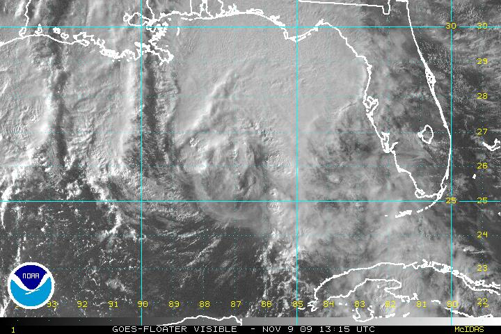
November 9th, 2009---: It's looking like I made the right decision in not going to intercept Hurricane Ida. She's falling apart rather quickly now as dry air and shear are ripping her apart. Ida will come ashore this evening around the Pensacola, FL area, and then will quickly make her exit into the Atlantic as an extra tropical system. Once she is gone, it will most likely be the end to the 2009 hurricane season. This blog will be retired until mid winter, when Dave and I are planning a snow squall chase in Toronto, Canada with our good friends Mark Robinson and George Kourounis! This will be something that neither of us have even done. I mean sure, I've documented many snow storms around the NYC area, but the snow events up near Lake Ontario are much more brutal with deadly wind chills, and in some cases, snow depths measured in yards, not feet! It's sure to be an adventure, and right now we're planning on doing this in January. So, I'll say so long until then! Until further notice, please refer to my "NYC Weather Blog" for the latest news from around these parts. I will be updating that blog several times a week throughout the fall and winter. Below is a recent image of Ida making a bee line towards the Gulf Coast this morning.
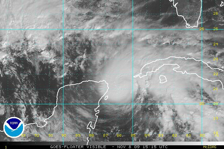
November 8th, 2009---: Ida is back to Hurricane strength this morning and not looking too bad right now, the key word is....right now. There is a massive amount of wind shear right in Ida's path, and she will begin to feel the effects of this shear over the next day or two. As of now however, Ida is in an area of relatively low shear and could become a Category 2 storm later today! If this were a few months earlier, we'd most certainly have a monster looming in the Gulf. Hurricane Watches have been issued for the Gulf Coast around the New Orleans area, and Mississippi coastline. Ida is forecast to come very close to the same area that Katrina hit back in 2005, however...this is NOT, nor will it be anywhere near the strength of Hurricane Katrina so no worries there. The official forecast track has Ida nearing the Gulf Coast early morning Tuesday, possibly moving onshore around the Mississippi area, and then turning east and moving over the southeast US. By this time, Ida is expected to have lost all of her tropical characteristics, but could still be a prolific rain maker. This storm should still be taken very seriously, and anyone living along the Gulf Coast, or southeast US should keep tabs on the latest forecasts from the National Hurricane Center website, as well as your local NWS. Below is the visible satellite image taken of Ida at 10:15am ET
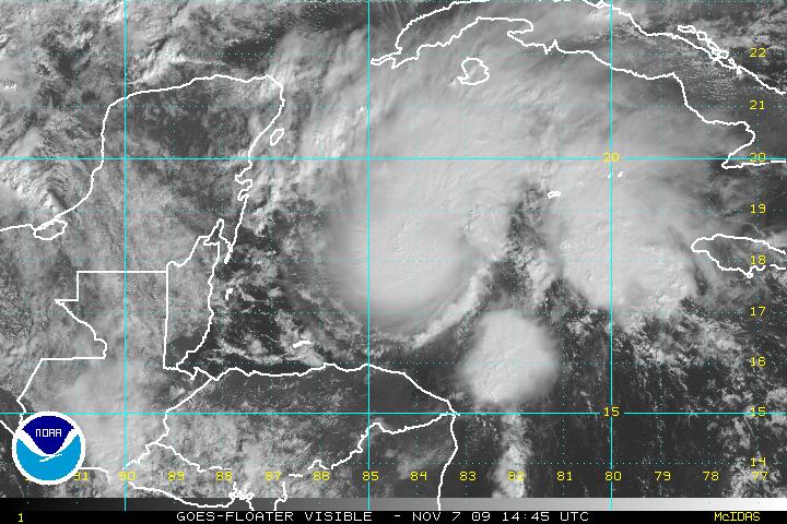
November 7th, 2009---: As expected, Ida started to re-strengthen last night and is now back to Tropical Storm status as of this morning! And judging by the recent visible satellite image (posted below), she's doing quite well at the moment. Nice central dense overcast noted, but this will not last long however. Wind shear is increasing along Ida's path, and it won't be long before she's battling shear in excess of 50mph! This will undoubtedly rip Ida apart, and she will get caught up in the westerlies and that'll be the end of her. But, there is still the potential for some more strengthening before this takes place, and Ida could become a hurricane once again, even if it's only for a short amount of time. Ida could bring heavy rains to the Florida peninsula in the coming days, before sweeping by and heading out to sea. It's looking like I won't be going for an intercept on this one though, Ida will be speeding by at a high rate of speed, and she'll be quite weak when she does move over Florida. Not worth the expense of traveling all the way down there I'm afraid. Regardless though, I will post another update either later today or tomorrow! It's not over yet, and if anything....I'm happy that I have something to track in the Atlantic, it's about time! lol
November 6th, 2009---: Hurricane Ida has weakened substantially over the last 24 hours due to land interaction with Nicaragua. Ida is now a tropical depression and is barely hanging on But, she is poised to head back out over open waters in a few hours and some strengthening is forecast. However, the official forecast doesn't have her getting back to hurricane strength. This time of year, wind shear is everywhere, and a huge trough swinging through the mid west is sure to bring extremly hostile conditions to the Gulf Of Mexico, which is where Ida is forecast to be in a few days. However, I'll still keep a close eye on her as anything is possible. Another update will follow over the weekend! below is an image of tropical depression Ida taken just a short while ago
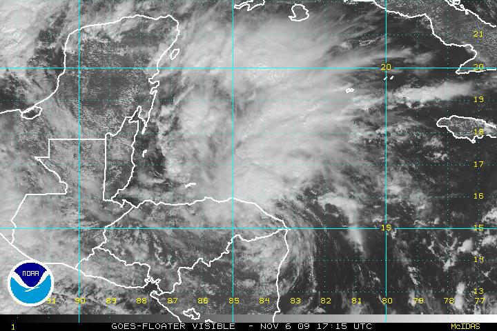
November 6th, 2009---: So much for TD11! TD11 went from a tropical depression yesterday morning, to Tropical Storm Ida during the afternoon and evening, and now she has been upgraded to Hurricane Ida! Ida is currently about to make land fall in Nicaragua, and then the forecast track gets tricky. The most likely scenario right now has the storm weakening back to a depression, due to land interaction, but Ida should re-emerge back over the open waters of the Caribbean at which time she could regain tropical storm, or even hurricane strength. A cold front sweeping across the US is forecast to affect the track for Ida by possibly pulling her northeastward, and towards the vicinity of Florida. All of this is still speculation though, for up to date forecasts on Ida, please refer to the National Hurricane Center Website As far as my plans? I will be keeping a close eye on Ida and will not rule out a possible intercept if Ida decides to really ramp up once again over the Carribean. Time will tell, but more updates will follow so be sure to check back! Below is a shot of Hurricane Ida taken at 7:15am
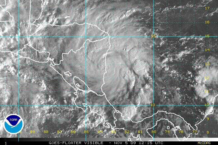
November 5th, 2009---: No less than 4 days after I put this blog to rest for the winter, and what is this we have brewing in the tropical Atlantic??? A tropical storm developing? LOL....what a surprise I have to say. I didn't think anything would become of the area of disturbed weather in the southern Caribbean sea, but this morning TD11 was born, and it's already on the verge of becoming Tropical Storm Ida. I'm certainly not going to hold my breath or anything, as the likely hood of Ida becoming a formidable storm threatening the US Gulf coast is a long shot at best. However, anything is possible so anyone living along the Gulf Coast states needs to keep a watchful eye on TD11/Ida over the coming days. She could move west and re-emerge over the Pacific, or she could head north towards the Cayman Islands and Gulf Coast. Way too early to tell right now.....more to come! Below is an image of TD11 taken at 12:45pm this afternoon
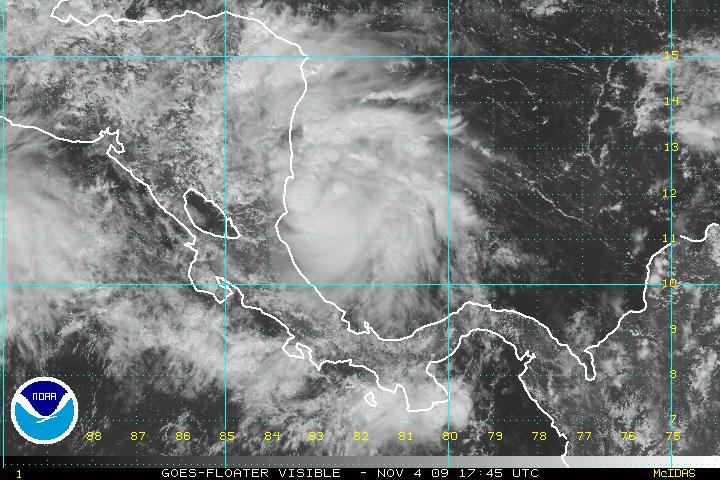
November 1st, 2009---: Well the time has come to put this blog to rest until either a snow squall chase with Dave in Canada this coming winter, or until next Spring when we once again start gearing up for our storm chase adventures on the plains! Until then, please head over to my NYC Weather Blog (the link is located on the navagation control panel on the left) as that will be the place where I'll be posting regular updates throughout the fall and winter on my activities around my home base of New York City! If you do not see the navagation control panel on the left, click on the link at the top of this page to be re directed to our home page.
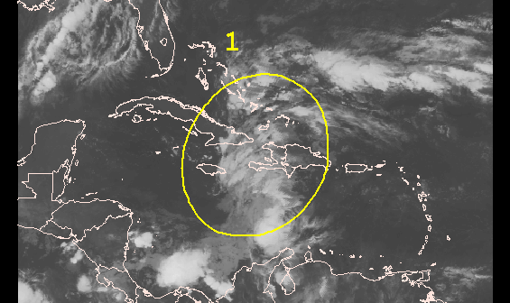
October 22nd, 2009---: I've all but given up hope on the 2009 Atlantic hurricane season, however I am still keeping one eye on an area of disturbed weather in the southwest Carribean that continues to bear watching. It's nothing major at all, and the National Hurricane Center is only giving this area a 30% or less chance of developing, still though, this is the area that is most prone to development this time of year. I will continue to watch, but won't get my hopes up. Below is an image of the area of interest in the southwest Carribean
In other news, I will be meeting up with my chase partner Dave Lewison, and fellow chaser Bill Hark this weekend in Manhattan for the big Photo Expo at the Javitz Center! We'll have to battle the rain and wind, but I'm sure it will be fun regardless. Dave and I are also planning a trip to Canada this winter to document the intense snow squalls that are very common during the winter months there! Stay tuned...
October 20th, 2009---: Here we are in late October and there could be something brewing in the tropical Atlantic over the coming days. Nothing I think that will be of much consequence, at least to the USA, but there is an area of thunderstorms near Central America that *could* form into something tropical over the coming days. Regardless, this area of storms will be slowly moving north in the coming days and I'll be keeping a close eye on things, just in case it develops into something more! However, I won't be holding my breath. With this being late October, my attention is being turned towards the winter season, and the upcoming snow events!
October 14th, 2009---: I've finally received my new 2009 Storm Chase Highlights DVDs back from the printers today, and they are now officially available! This 2 DVD set documents our best chases from the 2009 season, and I have to say, I feel that this highlights set is my best one yet! It's jam packed with tons of storm footage, spanning multiple days during this past June. Click on the "Storm Chase DVDs" tab on the left for full details and ordering info. In other chaser news, the 2009 hurricane season was a dud! It's looking like we'll all have to wait until 2010 for our next shot at intercepting a hurricane. However, the western Pacific remains active and chaser Jim Edds is stationed on Guam for the next few months awaiting development.
September 30th, 2009---: My 2009 Storm Chase Highlights DVD is completed and it's off to the printers for duplication! I will have them in hand and ready for shipping on October 14th! Pre-orders being taken now. See my home page for details. I'm really happy with the way it came out, definitely the best highlights DVD that I've done to date. Ok, enough of me hyping up my DVD, lol. On to storm chasing news......well, there really isn't any news to speak of! The Atlantic hurricane season has been void of any land falling systems. Here we are in late September, and still nothing brewing out there in the Atlantic. There's still some time left to the season, but my hopes are fading fast.
September 14th, 2009---: I've been hard at work the past week with editing my new 2009 Storm Chase Highlights DVD! And, as it stands...it's looking like it's going to be a 2 DVD set! More bang for your buck. I quickly realized as the editing process wore on, that there was no way I was going to fit everything on one disc without seriously compromising video quality. I should have everything wrapped up by week's end at which point I'll send everything off to the printers for duplication. And in weather news.....the tropics have been very quiet with no signs of anything chaseable during the next two weeks.
September 4th, 2009---: Tropical Storm Erika has fizzled in the Atlantic with not much hope of regeneration. And the rest of the tropics are rather quiet for now. El Nino and shear are the main negative factors at this time and it's uncertain what the future of the season holds. Technically, we are only a week from the height of the hurricane season, but...there's still plenty of time for something to materialize. We still have a good 6 weeks left to the season I'd say. Will continue to monitor.....In other news, I have begun editing my 2009 Chase Highlights DVD! It's scheduled for release in mid October. This will be my best highlights DVD to date! Lots of great footage was captured this year.
September 1st, 2009---: Nothing much came of Tropical Storm Danny. He remained very weak and was not worth going after. Actually, there wasn't much to go after to begin with, lol. But, after a few days of watching invest 94L in the Atlantic, the NHC has now upgraded this system to Tropical Storm Erika. There is still a lot of uncertainty regarding the future track of Erika, so we'll just have to watch and wait. She'll have many bullets to dodge (high shear forecast, upper level low's, etc). Stay tuned!
August 26th, 2009---: Less than a week has passed since Hurricane Bill passed us by and hit Nova Scotia, and already we're watching a new system in the tropics! Tropical Storm Danny was named this morning and he *could* affect parts of the northeast this weekend. Still a lot of uncertainty right now, but this bears watching for sure! More updates later today or tomorrow!
August 21st, 2009---: Well, it was a nice thought while it lasted. Hurricane Bill now looks as if he will pass too far off shore to make a Cape Cod trip worth it. Several of our good chaser friends are making the long trek up to Nova Scotia, Canada..but Dave and I just don't think it's worth it. That's a good 1000 mile drive from here, and with Bill accelerating and weakening by the time he reaches that area, we'd rather just hold off and wait to see what else comes down the pipe this hurricane season. I will however be taking a trip to Rockaway Beach tomorrow as 20+ foot waves are forecast there!
August 20th, 2009---: Ok, things are starting to get interesting now. At first it seemed as if Hurricane Bill was going to pass harmlessly out to sea, but now it's becoming more likely that he *may* move closer to the NE coastline than earlier expected. Nothing is written in stone yet, but it's possible that the Cape Cod, MA area may get brushed with some gusty winds, but more likely....high waves! Dave and I are contemplating a possible trip there this Saturday! The timing right now would bring the worst of the storm into that area around day break on Sunday, I have to be back in Queens, NY Sunday afternoon so needless to say, this trip has the potential to be a doozy! More updates to follow tomorrow!
August 12th, 2009---: The tropics are beginning to heat up! We now have Tropical Depression #2 out in the far eastern Atlantic, but what's garnering more attention is the tropical wave behind TD2! This wave is fresh off the coast of Africa and many of the models are forecasting this wave to become a storm within a week. What's more interesting is that all of the models take this "potential" system towards the USA. Stay tuned as things will most likely start getting interesting soon!!
July 24th, 2009---: Now that August is almost upon us, it's time to start watching the tropics! The pattern that we've been in for the last few months (ridge in the west, trough in the east) caused a tropical disturbance to ride right up the east coast yesterday, bringing us bouts of heavy rain to my area. While this system wasn't tropical, it is a sign that if the pattern holds for the rest of the summer, we could see a New England hurricane. However, I'm not holding my breath as the chances of that happening are still rather remote. But, it is possible. What's more likely is that within the next month we'll see our first named storm! Nothing is brewing out in the Atlantic right now, but I'll be keeping a watchful eye over the coming weeks! More to follow when things start picking up.
July 15th, 2009---: Cecelia and I will be heading to Myrtle Beach, SC this coming Friday for 5 days of relaxing on the beach, and of course.....some storm photography! The forecast calls for thunderstorms pretty much every day that we'll be there so I'm hopeful that I'll be able to rack up more great storm video over the course of the trip! Some of my best lightning video was captured in Myrtle Beach back in the summer of 2002, so I'm keeping my fingers crossed that I'll get a repeat of that.
July 9th, 2009---: I've just posted more photos from my June 2009 chase! Just click on the Photo Gallery link to the left, and then click on the "new photos" text. The rest of this month should be quiet, but it won't be long before my attention is turned towards the Atlantic as the hurricane season should begin to ramp up over the next few weeks! Next week, Cecelia and I will be taking a 5 day vacation to Myrtle Beach, SC where we plan to relax, swim and eat! However, I will have my camera with me as you never know when a good storm might pop up!
June 29th, 2009---: Still in the process of going through all the video I shot over the past few weeks, and picking out the parts that will ultimately become my "Chase 2009 Highlights" DVD! The DVD will not only show the storms themselves, but will also feature our get together at Jim Leonard's house in the Florida Keys this past March, as well as our chase preps, down days, and general whackyness that is our group. In other news....I have also put together a full length, timecoded Quicktime screener of my storm highlights which are now available for licensing. The screener can be found on my "Stock Footage List" page.
June 26th, 2009---: Still working hard and going through all the video I shot while on the road, but I took some time away from that, and posted some new video on the site! Visit our "latest video uploads" section to view video of the awesome hail storm we got into back on June 11th in Colorado. This video (and tons more) will be featured in it's entirety on my 2009 highlights DVD due out by late October.
June 23rd, 2009---: Still settling in after spending a few weeks on the road. Got lots to do this week, but I wanted to get some photos & video up on the site as fast as possible! Jump over to our "Latest Video Uploads" section for a 4 minute video clip of the Aurora, NE Tornado from June 17th. And also make sure to visit our Photo Gallery as I've posted many new photos under the "New Photos" section. I'll definitely be putting out a highlights DVD this year so be sure to check back for info regarding that over the coming months! I'll have one out by October.
June 20th, 2009---: We're finally home in NY! Gonna sleep for like a week after this one, lol. Dave and I were pretty much non stop almost every day of our 16 day chase trip, and what a trip it was! This was without a doubt my best chase trip ever! Pictures and video will be posted later this week so check back. Right now though, I need to sleep.
June 18th, 2009---: Yesterday was incredible!!! Got on an amazing supercell near Beatrice, NE and then drove the 100+ miles to Grand Island, NE where we captured an incredible tornado west of the town of Aurora, NE! Tons of great footage was shot and I'll be posting tons and tons of pictures upon my return. Today is our last chase day and then we begin the long drive back to NY tomorrow morning.
June 15th, 2009---: Today was another moderate risk bust for us and many other chasers as well as we were mostly congregated in the SW Kansas area. If however you were lucky enough to be playing around SE Kansas around Wichita, you were treated to a storm that produced several tornadoes! But, we did get some amazing footage none the less. The storms we were on gusted out with incredible force just west of Pratt, KS producing hurricane force gusts and some amazing gustnadoes which were all captured on video!
June 14th, 2009---: Tornado!!! Dave and I intercepted an amazing supercell thunderstorm today near Ulysses, KS. We witnessed a beautiful Elephant trunk tornado that lasted about 3 minutes before becoming wrapped in rain. Tons of great video and still pictures were taken, and I'll be sure to post them upon my return at the end of the month. We photographed this tornado on Route 160, which was the same road we photographed the Attica, KS tornado back in 2004. What's even funnier is that I was wearing the same shirt I had on during that chase 5 years ago, it was my lucky "Ball Of Twine" shirt, lol. We'll be chasing again tomorrow!
June 13th, 2009---: What a LOOOONG day!! We started the day in Colorado Springs, CO thinking our initial target was solid, well....we were wrong! About 10:30 last night Dave informed me that the target was changing and as it turned out, we had to haul out of there this morning at like 9am and drive over 400 miles to the Texas Panhandle! But, we made it in time and got on a great storm southeast of Amarillo. Dave and I punched through the core and entered the Bear's Cage where atomized rain was whipping past us at a high rate of speed, needless to say, things got a little hairy! Thankfully we made it through all right and as soon as we did, there was a huge wall cloud just to our west. At this point we were near Silverton, TX and we informed the local Fire Department that Silverton needed to be warned. A few minutes later, the tornado sirens went off in town. As we were shooting video, a brief spin up occured right under the wall cloud, this was witnessed by several other chasers as well. Throughout all of this we were dogging baseball size hail too! We blasted east down the 86 through Silverton where we met up with Cloud 9 Tours once again. As this was going on, George, Mark and Jack were getting trashed in the hail core, mind you this was George's plan all along since he was shooting another episode of his TV show Angry Planet. Dave and I however wanted to stay east of the worst of it and after shooting some more amazing video (to be posted when I get home) the storm dissapated, and we headed to Childress where we had a nice dinner. Dave and I are now in Shamrock, TX and will be chasing most likely in SE Colorado tomorrow!
June 12th, 2009---: Yesterday was an awesome chase day in SE Colorado! We got on a pair of supercells near Pueblo, CO and they offered up just about everything a great storm can, with the exception of putting down a tornado. But, it was still an amazing chase day none the less. We were treated to a golf ball hail barrage in the town of Las Animas, CO, and then encountered even bigger hail on the highway. This hail barrage lasted about 30 minutes and we shot tons of great video throughout all of it! This will definitely make my 2009 highlights DVD for sure! Trees were getting shredded everywhere, and the structure on the storms were incredible! There were still a bit high based however, and we think this may have been the reason why they didn't produce any tornadoes. Today looks like a possible down day, so if that's the case, we'll get an oil change on my truck (we've already driven it over 4200 miles!) and we'll do some sightseeing. More active weather is on the menu over the coming days so be sure to check back for more updates! Photos and video will be posted upon my return towards the end of the month
June 11th, 2009---: What a surprise yesterday was. As we were repositioning ourselves for a Colorado upslope play today, we decided to detour to SW Kansas just in case storms fired over there, well....they did! We got on a storm near Sublette, KS and were blasted with 80+ MPH downburst winds, small hail, blinding rains which forced us to stop on the side of the road, and even a nice funnel cloud that reached more than half way to the ground! All in all a great chase day. Today we're starting the day in Colby, KS and we'll most likely be playing in Colorado today for the upslope play. More updates tomorrow!
June 10th, 2009---: Nothing much to report this morning after the moderate risk bust chase yesterday. We all had high hopes with a 15% hatched tornado threat, but it was not meant to be. We tentatively thinking about chasing in northern Oklahoma today, but may opt to reposition ourselves for storms in northeast Colorado tomorrow.
June 8th, 2009---: Yesterday we chased some amazing storms from extreme northeastern Kansas, into NW Missouri. While no tornadoes were reported with this storm, we did see some amazing structure, got into some large hail, and were in the perfect position to view a tornado if one would have formed. Yesterday's chase proved extremely difficult due to a less than desirable road network. We spent a good two hours trying to position ourselves properly (along with about 500 other chasers, lol) and finally managed to do it right around sundown. At this point the storm really looked like it was going to produce a tornado as the circulation was tightening up almost right over our heads! I shot some great video of this rapidly rotating wall cloud as it was at it's most intense stage, but it just couldn't tighten up enough to produce. Oh well, we have 10 days left so I'm not worried. Besides, I would definitely consider yesterday a successful chase. Yesterday we chased with Bill Hark from Virginia, Cloud 9 Tours, Mark Robinson and George Kourounis who are both Canadian chasers. Today we *may* target Oklahoma if it looks good enough, still deciding that as I type. Check back tomorrow for more updates! And, don't forget that you can track us through our "Live Chase Tracker" link.
June 6th, 2009---: Targeted some nice storms in western Nebraska yesterday but missed the tornado that The Weather Channel was airing. Just couldn't make it in time due to the long drive from Topeka, KS that morning. All in all though it was a nice chase day with beautiful structure, some hail and lightning. Pictures will be posted when I have some down time. Today's target will most likely be SE Nebraska. You can track us after 4pm eastern!
June 4th, 2009---: Well we made it to Kansas! Today Dave and I drove over 850 miles from Western PA to Topeka, KS. We're holding up for the night and will leave here tomorrow morning heading west on I-70. Tentative target for tomorrow is McCook, NE. Starting tomorrow around noon time you can track us live on the "Live Chase Tracker" page.
June 3rd, 2009---: The big day has arrived! Our 2009 storm chase trip has finally begun. But first, I must finish packing all my gear before I meet up with Dave at his parents place in Larchmont, NY this afternoon. I'll be heading out of here around 3pm for the hour drive up there. We'll attach a few of the hail guards, and then will hit the road! We're hoping to make it as far as Washington, PA by midnight. Washington is in the western part of the state, due south of Pittsburg almost. Tomorrow we'll be doing the bulk of the driving as we need to cover a LOT of ground. More updates to follow!
June 2nd, 2009---: We're a go! Our chase trip will begin tomorrow! The models are coming into good agreement regarding the evolution of a trough in the west, and as of right now things look to get interesting late week. I will be meeting up with Dave Lewison tomorrow mid afternoon in Larchmont, NY where we'll attach our hail guards, grab a quick bite, and then hit the road! We hope to make it as far as Washington, PA tomorrow night (which is in the western part of the state) and then do the bulk of the driving on Thursday. We have a lot of road to cover but if all works out, we'll arrive in Kansas sometime around mid day Friday. I'll post another update tomorrow and will be frequently updating from the road so be sure to check back!
June 1st, 2009---: The models are coming into alignment and the news so far is good! An active period of severe weather is becoming more and more likely beginning this Friday! Right now Dave and I are planning on a Wednesday afternoon departure for a tentative target of western Kansas on Friday. The target for Friday I'm sure will change between now and then and we'll adjust as necessary. We've certainly been patient this year and May ended up being one of the slowest on record in terms of severe weather. Definitely the slowest in many decades. What will June hold? We're about to find out. I'll post another update tomorrow and will be updating from the road. Remember, if you're interested you can track us live as we chase by clicking on the "Live Chase Tracker" link on the left. On days that we'll be chasing, it will be flashing red and white.
May 30th, 2009---: It seems almost too good to be true but the models have been hinting at a ramp up in severe weather come late next week and into the weekend. The operational runs and their ensembles have been consistent for several days now and our hopes are climbing. However, we've had our hopes dashed many times already this season so I'll continue to remain cautiously optimistic. It was when we saw the ECMWF model (which is considered by many to be the best at medium-long range forecasting) coming on board with this scenario that we started getting a bit excited. Basically all our available model guidance right now is looking on board, so we'll see. The following quote is from the NWS out of Dodge City, KS. "....DEVELOPMENT OF A MEAN UPPER LEVEL TROUGH OVER THE WESTERN UNITED STATES DURING WEEK TWO IS CONSISTENT WITH THE GWO AND LIKELY WILL OCCUR AS ENHANCED TROPICAL THUNDERSTORM ACTIVITY SPREADS EASTWARD. A VERY ACTIVE PERIOD OF SEVERE WEATHER IN THE CENTRAL PLAINS IS LIKELY IN MID JUNE."
May 26th, 2009---: Dare I say it? Well, with the risk of jinxing everything, the models and their ensembles are showing a ray of hope come June. It's still too early to say this with any real confidence, but as of now things could start getting active again next week. It seems that Mother Nature took an extended break in May, and an unprecedented one at that! If I'm not mistaken, this has been the quietest May in terms of severe weather in decades! Many chasers were left scratching their heads out on the plains, and the Vortex 2 project has been suffering as well. But, this may change in the next 7-10 days. The GFS has been consistently showing a pattern change with a trough finally working into the west come the 2nd or 3rd of June. This would bring southwest flow back to the plains which up until now, has been non existent. For those of you with limited knowledge of the ingredients needed for severe weather/tornadoes, ideally you'd like to see southwest flow at the 500mb level, you can still have tornadoes without it, but the best tornado/severe weather days usually feature SW 500mb flow. There certainly are many other factors that need to be in place, but this would definitely be a start. Dave and I are hopeful that this isn't just another tease by the models and that we'll continue to see this trend on future runs. With the way this season has been going so far, anything can happen. Stay tuned as more updates will follow tomorrow!
May 22nd, 2009---: It was a year ago today that the devastating Windsor, CO tornado took place. Tomorrow, will be the year anniversary of the Quinter, KS tornado. WOW, what a difference a year makes! As of now, things still look pretty bleak for the remainder of May, however...there may be some chase prospects come this weekend in Texas. At this point, chasers out on the plains will take whatever they can get. I truly feel horrible for the Vortex 2 armada, they have had nothing to do for quite a while now and I'm hoping that their lucks turns for the better soon.
As far as the long range forecast is concerned, there is still hope for June, at least in my eyes. This horrible blocking pattern we've been in as of late is showing no signs of breaking down in the short term, however, there are some signs that a change may come at the beginning of June. Fingers are definitely crossed! A few of the features that have been stuck in place for over two weeks now (namely the Gulf Of Alaska Low) are showing some hints by the models of moving on out in a week to ten days. Now, this is all speculation at this point, by no means written in stone. But, at this point we'll take any signs of hope that we can get. The well respected Ed Berry will be updating his blog this weekend as well, and I'm eagerly anticipating his thoughts! Hope to have some good news by the end of the weekend.
May 19th, 2009---: Well, if you've been following along with my blog the past few weeks you know how much of an emotional roller coaster it has been. We've been teased with good looking set up's on the horizon, just to have our hopes dashed as the models flip flopped time and time again. Things are not looking any better today either. I would say that it's a good bet that the rest of the month will be pretty dismal as far as chasing goes. Nothing at all is looking good at the moment, at least until late next week, and even then it's still looking pretty bad. We're still hopeful that things will pick back up in June, but there are no guarantees so Dave and I started putting together a contingency plan in the event we never get out to the alley this year. It would be very depressing to say the least, and the first time in 10 years that I didn't get to go on my chase trip, but.....we have to face that possibility.
Right now this is the plan. If by the second week of June the medium/long range outlook is still dismal, we'll head down to South Florida and will chase/document the seabreeze thunderstorms along the east coast and central coast. And while late June isn't exactly the heart of waterspout season down there, it still can happen so we'll also target those as well. For the waterspouts however, we'd mostly be targeting the Florida Keys. We'll also have a pilot on hand as well. Our friend Tim Millar is an accomplished pilot and has offered to fly a rented Cesna for us! Flying around storms and spouts in Florida, yeah......I can see a barf bag in my future, lol. Well, again, hopefully this contingency plan will not have to be implemented, but if we can't chase storms out on the plains this year, we'll chase em' in Florida instead! While the Florida storms aren't exactly tornado producers for the most part, they still offer up hail, high winds, and TONS of lightning. At this point, that sounds good to me. More updates by weeks end! Hopefully things will start looking up by then.
May 16th, 2009---: As if things weren't stressful enough already, the dreaded "Death Ridge" is now settling in and this will effectively shut down any and all chase prospects for the better part of a week, perhaps longer! While Dave and I are glad we aren't sitting out there in the plains burning through time and money, I gotta be honest.....this year has been extremely frustrating! And, to make matters worse, there's now doubt as to if the forecast western trough for the last week in May will even be able to make it's way in. Ughhh, so there is the possibility right now that the rest of May will be void of any good chase prospects. This is not to say however that there won't be any storms at all over the next week to ten days. Many times you can find something to chase, even in a pattern like this. But, those prospects are few and far between, and for Dave and I we would be better to just sit tight. We can chase at any point in June as well so all hope is not lost by a long shot. But, it's hard to remain optimistic all the time. Once in a while I find a little bit of pessimism sneaking in, lol. However, there have been MANY great June chases in years past, and there's no reason to believe that this can't be the case this year as well. Unfortunately, there are no guarantees, so as been the case the last few weeks, the waiting continues.... Right now, all chase prospects will be minimal at least until next weekend. I'll update again in a few days, hopefully we'll have better news by then!
May 14th, 2009---: I've been holding off my excitement about the long range forecast since I didn't want to get my hopes up too early. And technically, it's still WAY too early to get excited but, I am seeing encouraging signs concerning the last week of May. For several days now (and many consecutive runs) the long range ensembles (GFS/Canadian) have been showing a western trough taking shape in about 8-10 days (5/22-5/25). Things until then are looking pretty bleak with a plunging cold front sweeping it's way all the way to the Gulf Of Mexico and thus, wiping out any and all moisture with it. It'll take several days for things to recover, but we're keeping our fingers crossed that timing wise, it'll happen by the time things begin to ramp back up.
Now, with that said there are no guarentees obviously, this is long range forecasting afterall, and when looking long range many things can, and most certainly will change. But, when looking out 8-10 days, we don't look for specifics, just the overall pattern, and right now it's still looking encouraging. So, it's possible that our annual storm chasing trip will finally begin sometime next week! There certainly were storms yesterday in Missouri and Illinois, along with Oklahoma and Kansas. But, with things looking bleak for the next week or so, we decided to pass in the hopes of a better overall set up. It's all gambling but when you're limited on time, gambling is what you have to do. We're hopeful it will pay off.
May 11th, 2009---: Here we are on May 11th and we're still waiting to pull the trigger on our annual storm chasing trip to the plains! Ughhh, yes the waiting and the stress continues. Up until now, things just have not been that conducive for severe weather out on the plains, so Dave and I have been holding off in hopes that the pattern will become more active towards the middle/latter part of the month. There are *some* signs that this may be happening at this time. Many of the ensemble members are forecasting a western trough late this week, and possibly into this weekend. They also show some more potential activity during the last week in May, but all that is pure fantasy land for the time being. Right now all we can go on is what the various forecast models are saying for this upcoming week, and with the way they have been performing lately, even forecasting this week accurately will be a challange. What we do know is that at some point we'll be out there, hopefully sooner than later. Some of the models are also currently forecasting what we call a "Death Ridge". A death ridge is when a large area of high pressure (fair weather) dominates the plains states, thus crushing any chances of severe weather. As has been the case the past few weeks, we'll just have to continue taking things one day at a time.
May 7th, 2009---: Well the confusion continues today! Dave and I have decided to stay put, for now, due to the model uncertainty regarding next weeks set up. Well, in actuality it's not so much of an issue of uncertainty like we had a few days back when the models were flip flopping back and fourth between a good severe weather set up, and a bad one. Now, they seemed to have locked on and are, for the most part in agreement that next week looks rather quiet. Tomorrow does hold some chase prospects in Oklahoma, and it could be good! But, these quick one day events while they can be rewarding, are just too much of a risk for Dave and I to take this early in May. We do have to drive 1500 miles to just get there afterall. But, come back and ask me in two weeks and if by then we're still in this marginal set up scenario, I'll give you a different answer, lol. Hopefully over the coming days we'll see a change to a more active pattern, but until then....we'll take it day by day. At some point this month however we will pull the trigger on the trip, but with this still being early May, we figured it best to just remain patient and see if a better overall set up comes along. More updates to come!!
May 5th, 2009---: This is the first time in several years that I'm still home as of May 5th. But, that's ok as patience this year I feel will be rewarded. However, what has been extremely frustrating to chasers is the fact that the forecast models we use to keep tabs on the upcoming pattern have been in disarray. One series of runs look good for next week, and then the next series of runs looks bad. And today, the drama continues!! This morning all looked quiet for next week once again, but like has been the case for several days now, once the 12z runs came in this afternoon, that once again changed and now it looks good! Needless to say, many of us are pulling our hair out, lol. But, that's the weather for you, we have take things day by day. Even though right now as I type things look good once again, I won't get my hopes up as this has happened many times before. Once I see some consistency from run to run, THEN I'll get excited! Check back tomorrow for more updates. As of now, preparations are continuing in the event Dave and I need to leave for the alley this weekend. Oh, and this year you can track us live while we're chasing! On days that we'll be chasing I'll activate the "Live Chase Tracker" link on the left side navigation control. When you see it flashing red, that means we'll be chasing that day. If it's not flashing, that means no chase is planned for that particular day.
May 1st, 2009---: Things are picking up out there in tornado alley! The past week has offered up some nice photogenic tornadoes in Texas and in Kansas back on the 29th. These set up's however were tough to forsee in advance and for folks like Dave and I (who live 1500 miles from tornado alley) need to see a more formidable set up before pulling the trigger on our trip. The next 7 days certainly have some chase potential, but it's mainly in the form of shortwave troughs, what we're waiting for is a nice western trough scenario, preferably a slow mover to boot where we can get several days in a row of chase prospects. I know....picky picky picky. Yes, this is true to some extent, but we want to choose wisely and in the end I think it will pay off. Right now the latest run of the GFS is hinting at a western trough diving in around May 9th. This has only been on one run so far so it is FAR from written in stone. But, we'll keep tabs on things over the coming days. In other news, Dave has beefed up the hardware for our new driver/passenger side hail guards! They are much more sturdy now. More updates to come so check back!
April 27th, 2009---: Storm Chase 2009 preps continue! I've just posted some new photos from our latest get together up at Dave's parents house in Larchmont, NY this past weekend. We continued on with our driver/passenger side hail guard construction, and also mounted our windshield hail guard. All went great! Put your cursor over the "Photo Gallery" link to the left and then click on the "new photos" section. And, to view a 7 minute video clip showing the latest phase of construction, as well as us mounting our windshield hail guard, visit our "latest video uploads" section.
April 25th, 2009---: I've just returned from Westchester County, NY where I met up with Dave again for phase three of the construction of our driver/passenger side hail guards. We got a lot done today. Just a few tweaks here and there and that's it! We took them for a test drive on the highway today and all went great. We also mounted the windshield hail guard on my Xterra, and hooked up the weather station, needles to say...it was a full day of work. Pictures and video will be posted on Monday so be sure to check back!
April 22nd, 2009---: Tis the time of year again where the stress builds as to when exactly to pull the trigger on our chase trip. But, it won't be for this weekend's set up, while Saturday and Sunday could certainly get interesting, it's not enough to get us to go out this early. We have to play our cards very carefully since we only have a certain amount of time that we can actually chase. It totals about three weeks a year, so needless to say, we want to choose as wisely as we can.
What I do have an eye on is what the ECMWF forecast model (bettern known as the Euro) is showing for the following weekend. As of now, it's showing what could be a large, slow moving trough diving down into 4 corners region..this *could* spell an extended severe weather threat, but with this still being 240 hours out, anything could happen. Things could change in a heartbeat so we'll just have to wait and see what the coming runs show. On another note, I'll be heading up to Dave's place in Wappingers Falls, NY this Saturday to finish up work on our new hail guards! (see our "latest video uploads" section for the video). We'll also be mounting the windshield hail guard to my Xterra. Should be a fun day, and for once, the weather seems like it'll cooperate with sunny skies and temps in the low 80s! I'll post more video/pics by Sunday so be sure to check back
April 13th, 2009---: Dave and I have completed stage two of our driver/passenger side hail guards! We met again this past Saturday in Larchmont, NY at Dave's parents house and got right to work. Unfortunately, the weather did not cooperate and it rained pretty much the entire day! But, thankfully we were able to do the majority of the work in the basement so even though it was miserable outside, we stayed nice and warm which was awesome. The rain quit right around 4pm and the timing couldn't have been more perfect. Just in time to get in some test fittings, etc...and overall, the day was very productive. We still have some more work to do and will get started on stage three the weekend of the 25th/26th. I have posted a 4 1/2 minute video clip showing our progress. You may have noticed I revamped the entire website, new logo, updated navigation panel, new background, etc. One thing I wanted to do was keep all new video I post in one central location so it's easy to find. So from here on out, all my 2009 video clips will be in the "latest video uploads" section. Just click the link located on the navigation panel to the left.
April 5th, 2009---: Yesterday I finally received all the parts needed for my new dash mount! The camera I will have mounted in my Xterra this year will be the Canon HV20. I used to use the VX2000/2100 but as of last season, I've upgraded to HDV. Another huge bonus is that the HV20 is MUCH smaller, therefore much easier to mount in the truck. I am using a Ram Mount set up, and have picked up a seperate ball head mount and quick release plate from B&H Photo. The mount has a super strong suction cup that will attach directly to the windshield. This set up is incredibly easy to set up, and take down at a moments notice. Next Saturday the 11th, Dave and I will be getting together at his parents house once again to continue work on our new driver and passenger side hail guards.
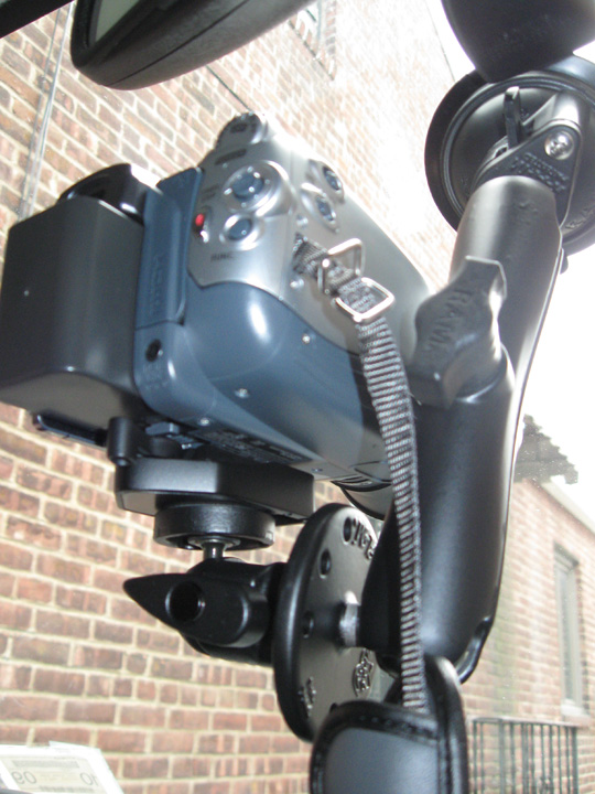
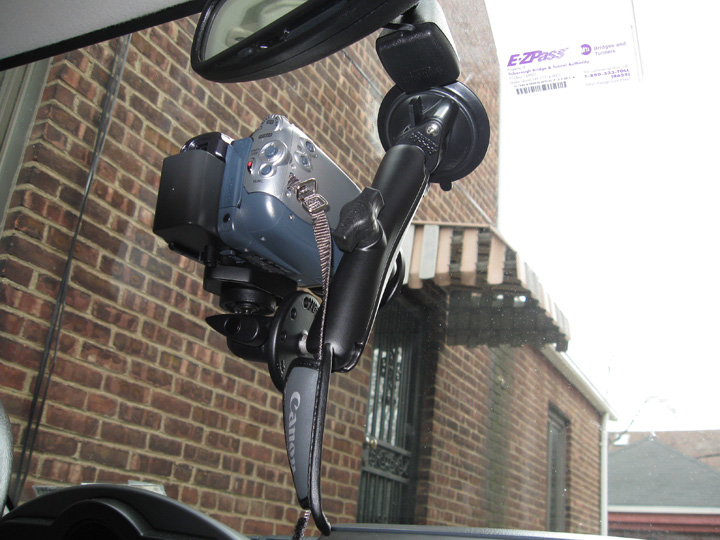
March 25th, 2009---: The first stage of our driver and passenger side hail guards went great on Sunday! I met Dave up at his folks house in Larchmont, NY (about 30 minutes north of me) and we got to work. While having lunch, we also came up with a plan to protect the rear tail lights as well! So all in all, it was a very productive day. A four minute clip of the fabrication process can be viewed by clicking the "latest video uploads" icon on the left side of the screen.
March 22nd, 2009---: After a VERY long winter Spring is finally here! We were greeted on the first day of spring with some snow flakes, but nothing accumulated. So, once again our annual storm chasing trip in just a few weeks away, but first we will kick off the spring with a small storm chaser get together at our good friend Jim Leonard's house in the Florida Keys! Next Friday, Cecelia, Dave and I will fly down to Ft Lauderdale where we'll rent a car and drive to the Keys for a few days of fun, sun & storm chaser videos! But before all that happens, first we have to begin work on our new driver and passenger side hail guards for my Xterra! The ones we have already are still perfectly functional, but up until now, we never had any protection for the actual driver and passenger windows. The main reason is that we couldn't figure out a way to have a retractable design so they wouldn't have to be in the "deployed" position all the time. Dave (the master engineer) has figured this out! Today I'll be driving up to Larchmont, NY where I'll meet Dave and we'll begin the work. I'll post some pics/video upon my return! It should take about 3 trips to get everything completed, so by mid April we should be good to go.
October 1st, 2008---: Ike is still in the news three weeks after he made land fall on Galveston Island and many folks are still unable to return to their homes. The damage in and around Galveston Island was pretty extreme and a DVD is in the works that will document Ike from birth, to land fall, to aftermath. While I am not directly involved in this production, I can tell you that it's sure to be a must see! Check back for more details..
September 12th, 2008---: Dave and I decided against intercepting Hurricane Ike. The main reason was due to the fact that he will be coming ashore well after dark. It's very difficult to remain safe during night land falling hurricanes (been there, I know) and from a video standpoint, well....you just can't get much due to the lack of light. All the best to those who went after him though. While the winds aren't in the Cat 3/4 range, the storm surge is! I know of a few chasers that are on Galveston Island right now, the water is already rising there!
September 3rd, 2008---: Dave and I did end up taking the plunge and we intercepted Hurricane Gustav in the town of Houma, LA. Things happened so fast I didn't even have time to update this page prior to leaving. Anyway, here's how it all went. Dave and I flew out of JFK this past Sunday the 31st and we landed in Jacksonville, FL around 4pm. Jacksonville was the closest airport we could get that wasn't going to be in the affected zone. Then, after getting the rental car we drove the 650 miles to our target area and met up with George Kourounis and Mark Robinson from Canada....as well as Tim Millar from Florida. But, getting to the target area meant driving through New Orleans at 2am when a curfew was in full affect. We both kept our fingers crossed and after getting turned around a few times by road blocks, we made it across the lake, and into Houma where we finally arrived at 3am! After arriving and greeting all our chaser friends who made it there before us, it was time to grab a quick nap before things started to pick up. We logged a righteous 1 hour of sleep before having to get up and get ready, lol
The show started around 6am and by 9am, we were receiving sustained winds in the tropical storm force range. This was by no means the predicted doomsday scenaio by any means, but Gustav did put on a good show for us when all was said and done. We documented the northern eyewall as it moved over Houma and were treated to a barrage of flying shingles, sheet metal, glass and tree parts. But, the real fun came when we were driving down Main street in the center of town and one of the above mentioned roof shingles came flying right through the passanger side window on our vehicle! Thankfully neither Dave nor I were injured, but now we have a problem.....no glass on the passanger side! We quickly retreated to the parking garage (which by the way was the same garage where the local police were housing their vehicles as well) and we proceeded to clean up as much of the broken glass as possible. Mark thankfully had some thick plastic sheets that we afixed to the door and in the end, this did help keep most of the rain out of the vehicle when we decided to venture back outside. Notice though, I said "most" of the rain was kept out, lol. After getting our fill of Gustav, we all decided it was time to start making our way back east towards New Orleans and points further so we got on the road around 4pm. George, Mark and Tim had a room in New Orleans and Dave and I proceeded to Crestview, Fl where we had a warm bed awaiting us...god did that bed feel good!!! And then yesterday, we flew back to NY. Wheew!! In the past 72 hours Dave and I have flown over 2000 miles, driven over 1300 miles, chased a hurricane, and lost a side window. Talk about a fun filled few days eh?! Now our attention has once again turned to the tropics as more storms are churning away over the open waters. Stay tuned! Oh, and if you are interested, click the link below....George had a Dateline NBC crew with him and they chronicled our Gustav intercept. Dave and I make a quick camero appearance towards the end. I have the blue rain gear on, and Dave has the yellow rain gear on!
Dateline NBC Hurricane Gustav Segment
August 28th, 2008---: What an eventful last two days it has been! Things still look on target for intercepting Gustav somewhere along the gulf coast early next week, where exactly is still anyone's guess. After pounding the coast of Haiti for a solid 24 hours or so, Gustav has finally moved away from that island, and after it's center reformed further to the south, he now has his eyes on Jamaica! He was almost torn to shreds last night by the tall mountains on Haiti's southwest coast, but we all were amazed at how fast he recovered this morning. There's little doubt that Gus will weaken somewhat as he traverses Jamaica, but I don't think it'll be that much. And, once back out over the open waters, he'll have the highest ocean heat content still ahead of him, not to mention an upper level anti-cyclone sitting on top of him. Many questions still remain but Dave and I have to commit by tomorrow for a Sunday flight out of NY. Stay tuned!! Below is a shot taken just a short while ago of Gustav as he approaches Jamaica.

August 26th, 2008---: Oh wow, that sums it up. Invest 94L went from a tropical disturbance to a Category One Hurricane in 24 hours and Gustav is not done by a long shot! More strengthening is forecast for the next few days and as of right now, the forecast track takes him into the Gulf Of Mexico over the weekend! Many things can and will happen between now and then, but needless to say....we're all keeping a watchful eye on Gustav. Dave and I would intercept this storm if he threatens the US, and our friends Mark Robison and George Kourounis from Toronto would be joining us as well. Initial preparations are underway and I'll have another update tomorrow so check back!
August 15th, 2008---: The tropics are coming alive, and we are watching closely as invest 92L moves towards Puerto Rico and Haiti! As I type this, 92L has not been classified a tropical depression by the NHC, but this could change at any moment. However, it's close proximity to land will most likely inhibit it from strengthening rapidly at least for the next 24 hours or so. It is getting better organized however, and it is a threat to the US so we need to keep a watchful eye for sure! Right now, the model guidance is having a tough time of things undoubtably due to the fact that it's a weak system, and more importantly....no one is really sure where the low center is exactly. If and when the system strengthens, the models should get a better handle on the possible track. Until then, we'll keep watching hour by hour! Stay tuned!
August 8th, 2008---: Cecelia and I have returned from our desert southwest trip and what a great time we had! Storms were sparse since the three days we were able to chase happened to be the three days that everything shut down. But, we still managed to get a few storms and the ones we did get were beautiful! We also spent a few days in Vegas with my friend Jeff, and also got to check out the Grand Canyon, Meteor Crater, Lake Havasu and the London Bridge...and finally, Phoenix. Photos are now up on my "New Photos" page, check them out! Next up on the list will be the hurricane season which should be ramping up soon now that we're into August. More to come!!
July 23rd, 2008---: Here we are at the height of Summer and the tropics have started off with a bang! Hurricane Dolly is making land fall as I type this near the Texas/Mexico border as a Category two hurricane. This was the one week that I could not chase due to the fact that our yearly summer vacation starts this Friday. Cecelia and I are heading to the desert southwest! We'll spend a few days in Vegas with my friend Jeff, then it's off to the Grand Canyon for a day, and then we'll try our hand at some lightning chasing in and around Phoenix for a day or two before returning home the following Friday. Even if I wasn't going anywhere this Friday, I would have still passed on intercepting Dolly. To travel all the way down to practically the Mexican border for a Cat 2 hurricane would not have been worth it. That entire area down there is pretty desolate to begin with, nothing really in the way of shelters at all! I will post pictures upon my return so be sure to check back for those!
June 10th, 2008---: Our 2008 spot chase ended on a high note! Actually...the last two days of our trip (June 6th & 7th) were very eventful! On June 6th we were with Cloud 9 Tours and Chris Kridler somewhere in extreme northeastern Oklahoma, near the town of Claremore. It was 6pm and it just didn't look good at all so we decided to call it and started to head back north in the hopes of making it as far north into Kansas as possible to set up for the next day's chase. We noticed that the surrounding storms had taken on a more appealing look so we decided to pull off the road and get some video. From there, it was all uphill! One of the storms had taken on supercell characteristics so a very important decision had to be made.....do we chase this even though on radar it didn't look very good at all, or do we say forget it and continue on north as planned. Well, thank god we decided to go for it because what we had on our hands was a nice structured LP Supercell. LP storms have poor radar presentations due to the fact that they do not carry a lot of precipitation with them, therefore they do not show up on radar too well. We got on the storm and it just looked better and better as time went on. It even developed a wonderful tail cloud and adjacent wall cloud that for a while there, we thought might put down a tube! It didn't in the end, but it did produce a pair of "kissing funnels" as I like to call them. Basically two horizontal vorticies connected with eachother under the wall cloud, it was the most crazy thing I'd ever seen and apparently, pretty rare to boot! The setting sun lit up this storm in gold, yellow and pink near the town of Pittsburg, KS...truly amazing to see and a great way to end our next to last chase day..the following day would be even more interesting!! Read on.....
We started the day in Fort Scott, KS where we agreed that our target area for that day would be somewhere in either south central Nebraska, or north central Kansas. We headed out around 10am and much to our surprise, Chris Kridler (who was set to fly out that afternoon) decided to hang around one more day and chase with us! A great surprise and well worth it in the end. We headed up route 69 in extreme eastern Kansas and while cruising along, we had a 2002 or 2003 Black Camaro pass us on the shoulder moving at around 120 mph, no I'm not kidding...lol, and right after that a cop car went flying by. It was a high speed chase!! WOW, I've never seen that before. Anyway, back to the chase. We arrived in Beatrice, NE around 3pm and spoke with Charles Edwards of Cloud 9 Tours. We discussed the days target and Charles informed us that there were some cells going up in Kansas to our southwest...maybe about 85 miles away. At this point however I have to admit, I wasn't too excited due to the fact that they looked pretty linear and I figured that was it for the day...we're going to have a raging squall line. Well, it didn't work out that way. The line never fully formed, or I should say...never unzipped all the way down into southern Kansas. Instead the storms just kept rebuilding over the same area. We decided to head down that way and investigate. Basically there were three storms we were interested in towards the southern end of this line. We investigated the northern storm first and that one looked okay, but a bit too high based for our liking. Still though, we managed some great photo ops before deciding to move on to the middle storm. That storm was located near the town of Jewell, KS. Jewell had actually been hit by an EF3 tornado just two weeks before, so it was a sight to see a supercell and wall cloud in the background with the still fresh tornado damage in the foreground. After about 30 minutes of grabbing video and stills from that location (and getting eaten alive by musquitos) we decided to investigate the southern most cell. This cell had now become dominant and WOW....what an amazing storm this was!!! As we got closer we could see the classic UFO/Mothership appearance this storm had. I was in awe and couldn't wait to get closer and we all felt that this storm had the best shot at producing a tornado. We passed the town of Cawker City, KS (where the world's largest ball of twine is located) and then through the town of Downs, KS where by now..the base of the supercell was clearly visible. We decided to pull off at the intersection of route 281. We could hear the hail roar from this storm and knew that we had to proceed with caution. We shot video for a while and the entire time we could see the base rotating and the wall cloud which was now visible to our west had a classic look to it. Right as we decided to reposition a bit further east a funnel became visible and about a mile down the road, we pulled back over and set up our cameras in anticipation...this was it!! The wall cloud was now just to our north and spinning like a top!! After about a minute of shooting video we could see that a tiny pencil like funnel was forming and before long, it touched down and we had a tornado!! It was brief and small, but it was a tornado none the less and needless to say....we were all very excited! We decided to follow this storm after the sun set since it still had an amazing radar presentation on it, but it did not go on to produce another tornado. Well, not any that we saw at least..but there were some ominous funnel like clouds that we witnessed right at twilight. An amazing day overall and a nice way to end our 2008 spot chase! We started the long drive back to Colby, KS where we set up for the night...got about 4 hours of sleep and then drove back to Denver to catch our flight home. Wheew!!! What a trip!! Below are two radar images. The first one was of the surprise LP supercell near Pittsburg, KS on June 6th, and the second image was of the massive tornadic supercell near Downs, KS on June 7th (look at the hook on that one!!)
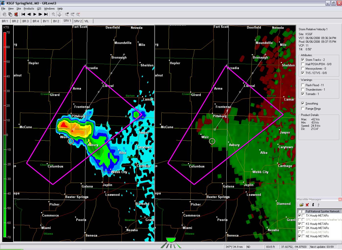

June 5th, 2008---: Dave and I flew out on Jet Blue to Denver on Tuesday evening and we arrived around 10:45 local time. We grabbed our rental car and headed off to Limon, CO where we'd hold up for the night. We got into Limon around 1am so needless to say, we were BEAT! We got about 6 hours of sleep and then headed out early the next morning to our target area of south eastern Nebraska. We hooked up with Charles Edwards and Cloud 9 Tours and thus began our chase! We did intercept some nice cells in and around Kearney, NE but it was pretty clear that we weren't going to be any tornadoes. Still though, we managed to get some nice video regardless and overall were happy with the day. But, what we didn't know was that soon....things would get really interesting!
Around 11:30pm I heard a knock at our hotel door and it was Charles Edwards saying that Kearney was under a tornado warning. I thought he was joking initially, but soon realized that he was not kidding after looking at the radar. Just to our west was a nasty cell just about to over take us. At that point I began to hear quarter size hail hitting the ground outside and I knew that we had to move fast. I woke Dave up and then quickly grabbed my video camera and car keys and hauled it out the door and down the hallway. I ran outside and jumped in the car in the hopes of finding some shelter so we didn't lose all our glass. As luck would have it, there was a Casey's General Store right next to the hotel, and attached to the store was a gas station with an overhang! I raced over there and pulled up under the overhang where I found another car sitting there awaiting the storm.
Within seconds the hail began to fall and this time...it was bigger! It was a golfball barrage with some rouge tennis ball size hail in there for good measure, lol. With the extreme winds that were now blowing, the smaller hail stones were sneaking in under the overhang and nailing our rental car. I was rolling video through all of this and I got some great shots of the bigger stones smashing into the puddles and in turn ejecting water up off the ground a good two to three feet in the air! It was insane, and VERY loud! Dave was holding up in the hotel rolling video from our room. I haven't seen it yet but from what he tells me, he was sure the glass was going to shatter in. Things wound down after about 10 minutes and then we all shared our stories and then, finally....settled in for the night. Upon waking up this morning and accessing the damage, we realized that many cars in the hotel parking lot, as well as the hotel itself sustained damage. The owner of the hotel lost her side glass, and several rooms in our hotel had also lost glass. A car dealership next door also suffered major damage to several of the vehicles that were out in the open lot. All in all, it was a VERY interesting way to end our first day chasing. Our second day however would not be as interesting.
Today was a high risk and we really didn't see much of anything, lol. Basically after some discrete storms early on, everything congealed and now there is a raging squall line that takes up about 5 states going on right now. Tomorrow holds some hope in southeast Kansas/northeast Oklahoma so we'll see what we can get! We are not going to chase Illinois, but instead will play the southern end of things. Stay tuned! More updates to follow!
June 3rd, 2008---: After much thought, and stress.....Dave and I have decided to pull the trigger on our 2008 spot chase. We fly out this evening to Denver and will do our best to make some headway tonight before stopping and getting some rest. Tomorrow and Thursday definitely hold potential, but there are some major concerns. A strong cap and possible veered 850 flow are the two main ones. But, overall many of the parameters are in place for what could be an interesting few days. Saturday also holds potential as well, as does Sunday. Our plan right now is to fly back to New York this coming Sunday the 8th. If we see that Sunday looks like an outbreak day, we'll most likely stay and fly home on Monday in that case. Check back as I will be updating as often as possible from the road!
May 21st, 2008---: Our 2008 main storm chase trip has been completed and I'm in the process of editing up all the video I shot while out on the road. We managed to get on some decent storms while we were out there so overall this years trip went rather well. However, a potentially active period out on the plains is imminent and unfortunately Dave and I can't be out there this time around. The timing is just bad for us since we have some obligations here. We needed at least a week or so between our main trip, and our spot chase where we fly out and rent and this time around things just aren't panning out in our favor. Best of luck however to all those who are able to chase these next few days! Dave and I will be ready to head back out for a few days anytime after May 27th. When the next multi day set up comes along, we'll be there! Check back as I'll be posting some video soon!
May 15th, 2008---: Yesterday we got on some great storms near San Angelo, TX. We first encountered a nice LP Supercell and got some great shots of that, but soon our attention was turned to the southern cell which was rapidly taking over. That storm turned into an HP monster with the most incredible, and insanely close lightning strikes I've ever witnessed!! At one point we were almost struck while taking shots on the side of the road. The bolt hit just across the road and for a brief second, I thought we were done for. It really did scare the you know what out of me, and we all quickly jumped back into our vehicles. That was it as far as getting out of the cars went until we were far enough away from the storm and felt relatively safe again. Rotation was clearly visible on this storm and right as we got to the town of Brady, TX.....the hook wrapped in on us. I saw the rain curtains rotating right in front of us and at that point we figured we were going to get into some sideways flying baseballs! lol...Turned out there wasn't any hail in the hook, but damage was being done all around us as we drove through the town and we really did want to get out of there as far as possible. If this storm had a tornado at that moment, it would have been pretty close to us. We stopped a few more times but eventually the storm pulled away from us, but not before we managed to grab some more great shots! Today our chase trip ends, and we begin the LONG drive back to NYC. We should be back home by Saturday, and I'll be sure to post many pictures, and video clips next week. Check back for those!
May 12th, 2008---: We stayed in Enid, OK last night in the hopes that a potential western Kansas target would verify. When we awoke this morning at the Days Inn, we quickly realized that this was not going to happen. So, we decided to head back down the I-35 towards Norman, OK and we're here again at the Guest Inn. There are two possible targets for tomorrow, and both are not too far from this area. We're hoping that we at least get to see some interesting weather tomorrow, especially after the extreamly frustrating chase on Saturday in the jungles of southeast Oklahoma/southwest Arkansas. Stay tuned!!!
May 11th, 2008---: Storms were around yesterday, but we honestly didn't see much due to the horrible roads and terrain. Most chasers did have this kind of luck, but there were a select few that got on the storm in northeast Oklahoma that produced the damaging tornado there. Unfortunately there were many fatalities from this particular storm. Something we never like hearing about. Our thoughts go out to everyone affected by this storm. Today is a travel day and tomorrow we could be back in western Kansas chasing! Then Tuesday could be in Oklahoma once again, and finally....Wednesday in north/central Texas. After that three day stretch, it's back home to NYC! More updates to come!!
May 8th, 2008---: The day began with a slight risk for western Kansas. We decided to go for it and were certainly glad we did! While there were no tornadoes sighted, we did see just about everything else a Great Plains Supercell had to offer. We left Norman, Ok around 11am and headed east on I-40 and then northward on the 183 towards Woodward, Ok. We were heading towards the Dodge City, KS area when we noticed that a few storms had already begun to explode near Garden City, and points north. We blasted west on the 54/400 out of Dodge City and intercepted the southern most cell. This storm really really tried to put one down! It had everything! A massive hook echo appeared on radar and it was very clear to all of us that the storm had a lot of rotation to it! We filmed some great structure, and continued to hope that it would put one down since it was over completely open land, but it just couldn't do it. Actually, it had put a tornado down before we were able to get to it, but still...no complaints from me! This was more than all of us had hoped for today. We also had the crew from Pioneer Productions in tow with us as well today so it was nice that they got to see something too. Got a lot of great shots today. Below is the radar image I was referring too..just look at that hook!! Tomorrow is a down day so we'll be doing a bunch of filming with Pioneer for Raging Planet 2....Saturday looks like the next chance of storms.

May 8th, 2008---: Dave and I are here at the Guest Inn in Norman, OK. It's been about 3 years since I've stayed here and it's nice to be back! The Guest Inn in a popular stop for many chasers heading through the area! Jim Edds, Jim Leonard and Michael Laca have headed home for the time being but Dave and I are hopeful that things will pan out for next week. Right now the models disagree on the severe weather threat for next week. The GFS paints a nice picture, the Euro paints a bleak picture. We'll be keeping our fingers crossed. For today, Dave and myself along with Mark Robinson and Dave Suddaby will be heading into Western, KS for the possibility of some elevated supercells popping up there later this afternoon. The tornado threat is minimal, but we'll be happy with some nice structure shots, some hail and some lightning! I'll keep you posted!! One more note about yesterday. We stopped for data in Greensville, TX and wow what a chaser convergence there was there!! Everyone from Charles Edwards and Cloud 9 Tours, to Reed Timmer were there! We chased in the northeast Tx, southeastern OK area but to no avail. All the storms quickly lined out and we decided to call it a day and head north to get into position for the possible Kansas storms today.
May 5th, 2008---: Dave and I just pulled into Amarillo, TX about 10 minutes ago. It's now midnight and we started the day in Lawrence, KS. Man oh man did we drive A LOT today! We played around in a storm just north of Woodward, OK this afternoon and shot video of some nice pea size hail, lightning, etc. Setting up here in Amarillo for the night in hopes of an interesting day tomorrow. Tomorrow we'll be hooking up with Jim Edds, Jim Leonard and Michael Laca! Stay tuned!
May 4th, 2008---: We stopped last night in Washington, PA after a solid 8 hours of driving yesterday afternoon/evening. Washington, PA is located in the extreme western part of the state and we'll be heading on westward in about a hour towards the plains. Right now there is a good chance of storms in western Kansas tomorrow evening, and we want to make it there in time. Tuesday and Wednesday also hold some promise and we're also keeping our fingers crossed that this secondary trough that some of the forecast models are predicting will actually materialize. Today we'll be covering a lot of road and we're hoping to be in Missouri by this evening. More to come!
May 3rd, 2008---: Dave and I have decided to pull the trigger on our trip this afternoon! Lots to do in the next three hours. I'll be leaving here around 1pm and will drive up to Fishkill, NY where I'll pick up Dave and we'll start heading west. We're hoping to make it to eastern Ohio tonight where we'll set up for the evening. Tomorrow we'll be meeting up with Mark Robinson somewhere in Ohio most likely. More soon!!
April 28th, 2008---: Without jinxing it, things are starting to look pretty interesting for the early part of May! There could be a good set up out on the plains this coming Thursday the 1st, but Dave and I cannot leave until the 1st so there's no way we'd make that. But, if the various models are correct, then we may be entering an active period come May 3rd or so, and that we CAN be there for! For now, we're tentatively planning on leaving Friday afternoon or Saturday morning. For once it's starting to look like we may be able to take our time getting out there instead of having to do the marathon drives of seasons past.
We'll make the final decision on whether to pull the trigger or not on the trip by Tuesday/Wednesday of this week. In any event, my chase preparations are continuing on as planned and I'll have everything in place by Wednesday in case we need to head out on the road by weeks end. Check back for more updates tomorrow!
April 22nd, 2008---: For the time being at least, it looks as if the first few days of May will not be conducive for severe weather. The ECMWF model is currently forecasting a huge trough in the east with a plunging cold front making it's way all the way to the Gulf Of Mexico. If that verifies, there goes our moisture/heat source..lol. The other medium range model (the GFS) paints a bit of a different picture so right now it's not too clear as too exactly what will happen, but as is always the case, we'll be keeping an eye on things. It could turn in the other direction in a heartbeat. Either way, Dave and I will be on standby to leave anytime from May 1st onward!
Now on to our hail guard designs for my Xterra. I've been asked many times exactly what they look like, how they were made, etc. Well, Dave has posted a very in depth explanation as to the in's and out's of it all. Starting from the basic ideas, to the construction, to the finished guards. Click on the link below to be taken directly to Dave's hailguard explanation page!
Hail Guard Explanation & Photos
April 21st, 2008---: Our 2008 chase trip is rapidly approaching once again! Yesterday, I met Dave in East Fishkill, NY at our friend Marc's house to do our yearly hail guard maintenence. But this year we also needed to test fit our new "roof cam"! Both Dave and I are incredibly excited to try this out in some hail. Not huge hail, lol...but golfball size would be nice. After we completed inspecting the windshield hail guard for any cracks or broken welds, we bolted it onto my roof rails, and then proceeded to replace my old car battery with a brand new Die Hard! Then we replaced a few parts on the Lexan hail guards, ate some lunch, and then did a little go-carting to round out the day! I've posted some pictures on our "New Photos" page, be sure to check them out! If all goes to plan, we could be on the road within 10 days (weather permitting of course) More updates coming soon...
April 10th, 2008---: Well, Dave and I decided to hold back on our planned trip for this week. And, so far it seems that we made the right choice! While there were some interesting storms and a few tornado reports in Texas yesterday, it would have been extreamly difficult to drive all the way to Abilene, TX from Denver, CO the night before. We would have had to drive all night to make it there for initiation, and even then....who's to say we would have gotten on the one storm of the day. That storm produced a brief tornado near the town of Breckenridge, TX. Many chasers were on the storm and reported a rain wrapped tornado briefly on the ground. There were also reports of tornadoes in Oklahoma as well, but several were after dark. Today looks to be one giant mess in Arkansas and Missouri with fast storm motions, horrible terrain, and tons of rain....Oh, I'm sure they'll be many many severe weather reports, and even some tornado reports, but this isn't a dream type set up for storm chasers.
Dave and I have a credit with Jet Blue that's good for a year, and I'm sure it won't take a year for us to use that credit! More than likely we'll be using it within the next few months. We feel pretty confident that we can pick a much better set up to use this credit on! Stay tuned as chase 2008 preparations continue!.....
April 6th, 2008---: Dave and I are keeping an eye on this next trough moving into the plains around the mid week timeframe. Right now the timing doesn't look that great, and moisture return might be a problem for Wednesday, but we have about another 36 hours to ponder over model runs before we have to make a decision. We did go ahead and booked a flight out on Tuesday evening to Denver on Jet Blue, and a return flight on Sunday the 13th. Why to Denver? Well, Jet Blue had very reasonable airfares unlike all the other airlines at the last minute, but.....the downside is Denver was the closest "mid west" city we had the choice of flying into. The problem with that is this...would we be able to make it to the target area on Wednesday if that ends up being down in northern/central Texas, and if not...will the moisture make it up into the Oklahoma region making for better chase prospects up there. Oklahoma would be easier for us to reach starting from Denver than north/central Texas would be.
Aside from all of this, any chase prospects on Thursday right now look to be pretty far to the east in less than desireable chasing terrain. Chasing in the hills and trees of Arkansas isn't very appealing, lol. I dunno, we have some more time to ponder over things before having to make a decision. The nice thing is that if we do decide to cancel, we will be given a credit that will be good for up to one year on Jet Blue. Dave and I have no doubt that we'll use that credit either later this month, or in June. Let's not forget that our annual May chase trip is coming up FAST! Either way, it won't be long now until we're out there doing what we love to do! More updates following soon...
March 20th, 2008---: After a long, but not so brutal Winter, Spring is finally here!! Plans and preparations are underway for this years storm chasing trip, and it won't be long now until we are on our way. To start Spring off, I lended my advice to The Weather Channel for their Tornado Prepardness Week, and last night they ran my segment...below is a screen cap from that segment. We talked about tornado safety and overall I was happy with the way things turned out. Check back often as this page is going to be updated on a regular basis. I plan to update a lot more this year than in the past.

October 10th, 2007---: Well here we are in mid October, and still no landfalling hurricanes, well...there was Humberto, but that one caught us all off guard, and I couldn't have justified the expense of traveling down to the Gulf Coast for a minimal Cat One. Looks like 2007 will be another slow year for landfalls. It's not that the season as a whole has been inactive, there have been a good amount of storms that have formed in the Atlantic. Excessive shear seems to be the rule this year, and shear was responsible for ripping apart several potential candidates. That's nature for you. If we finish out this month on a slow note, then it's time to settle in for the long winter ahead. Spring can't come soon enough! lol....
September 6th, 2007---: Watching and waiting. That's what's been going on since Hurricane Felix, which was the second Category Five hurricane to make landfall this season charged inland over Honduras and Nicaragua a few days back. We still have a long way to go, and there is certainly the threat of more hurricanes roaming the Atlantic over the coming month. Stay tuned......In other news, work has begun on the Hurricane Dean DVD which will chronicle Dean's entire life cycle.
August 22nd, 2007---: Hurricane Dean has made his final landfall in Old Mexico this afternoon as a category two hurricane. Dean weakened substantially over the Yucatan, but did manage to regain some of his strength over the Gulf before making his final landfall. However, he was a far cry from the Category 5 monster he once was. And, in chaser news.....Jim Leonard, Jim Edds, George Kourounis and Peter Rowe all made it back safely this afternoon from Jamaica! We're all back in "waiting" mode, and I wouldn't expect this lull in the tropics to last much longer. Stay tuned!
August 21st, 2007---: Hurricane Dean made landfall very early this morning near Costa Maya, Mexico as a very rare Category 5 storm. This is the first Cat 5 to have made landfall in the Atlantic basin since Andrew in August of 1992. No chaser's that I know personally went after Dean in the Yucatan. Aside from landfall being in the middle of the night, the areas south of Cancun and Cozumel are very desolate...I wouldn't want to ride out a Cat 5 there to be honest. I have heard from George Kourounis, Peter Rowe (George's Producer on Angry Planet) and Jim Leonard and they are scheduled to fly back to Miami this afternoon. Jim Edds will be on the Fox News Network sometime this evening, and will be flying back home to Pensacola, FL tomorrow! Check out our Hurricane Dean Video website for video clips of Dean as he brushed the south coast of Jamaica near Kingston.
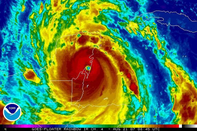
August 20th, 2007---: Hurricane Dean brushed the south coast of Jamaica yesterday with winds at times over 100MPH! Storm Chaser Jim Edds was there to document the storm, and rode it out safely in Kingston. To view video clips of the storm as it pounded Jamaica, click on the Hurricane Dean Video link below.
Storm Chaser's George Kourounis, Brad Riley & Jim Leonard were also in Jamaica for Dean, and are all safe! Mike Theiss, another good friend and fellow storm chaser intercepted Hurricane Dean on the island of Dominica. Mike is back in Miami now safe and sound. To view an interview that Mike did with The Weather Channel, Click Here
*3pm Update* I just heard from George Kourounis (www.angryplanet.tv) and his producer Peter Rowe. George and Peter are with Jim Leonard and all are safe! They documented Dean from the east side of the island and captured "pretty intense footage" of the debris filled storm surge washing over the road. I also spoke to Jim Edds and Jim is safe, and currently documenting the aftermath near Kingston. Jim's video can be accessed Here
August 19th, 2007---: Hurricane Dean will move very close to, if not over the island of Jamaica later today. There's definitely a part of me that wishes I could be there, but I've always been a little leery of island intercepts, and the last minute airfares were less than desireable to say the least...lol. But, Jim Edds is there ready for the intercept! As it stands right now, a US landfall is looking less and less likely, but we'll still keep a watchful eye on the future track of Dean regardless.
August 18th, 2007---: Dean is now a Category 4 hurricane and headed for the island of Jamaica. As of right now Dean looks to hit the island head on, but Jamaica is a small target so he could still miss her to the north, or south. As far as a US threat is concerned, the model consensus has Dean hitting Mexico during the middle of next week. However, the GFDL which I consider to be a very reliable TC model has Dean going through the Yucatan Channel and hitting Texas. Even though that model is the outlier right now, it shouldn't be discounted. Everyone along the Gulf Coast should still be keeping an eye on Dean. For me, preparations are being made in the event Dave and I have to head out of here around the Tuesday timeframe! More updates to follow.....
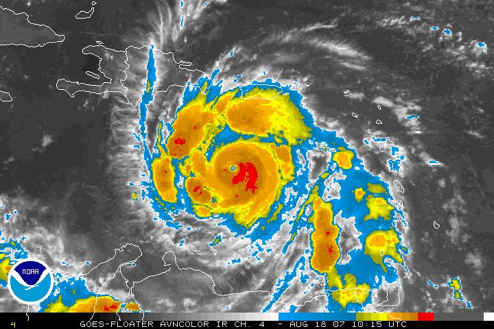
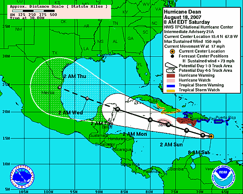
August 16th, 2007---: Dean has been upgraded to a hurricane, and he's steadily intensifying as we speak! A recon mission was schedualed for this afternoon, so by tonight I would expect the models to have a better handle on Dean's future plans. Nothing ever is written in stone of course, but models usually are a bit more accurate once they've ingested actual data from a recon mission. Many of the models have been pointing towards a Yucatan strike, but I'm not completely sold on this just yet. There's an upper level low near the Bahamas that if stronger than forecast, could affect Dean's future track. A few of the models have already picked up on this possibility and have adjusted their tracks a bit further north. Most notably, the 12Z run of the GFDL, which usually is a very reliable model. The 0Z runs should be out by 11pm this evening, so the 5am update from the NHC should be more accurate (hopefully...lol). Lots can, and will still happen so check back daily for updates! In the meantime, Dave Lewison, Jim Edds and myself are making preparations in the event a US landfall becomes a likelyhood.
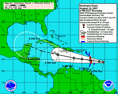
August 14th, 2007---: Tropical Storm Dean was born today in the Atlantic, and Dean could possibly be a threat to the US in about a week. But first, he'll be a threat to the Leeward Islands, and possibly Puerto Rico where residents are already taking precautions! Dave, Jim and I are in "tracking" mode for the time being and if Dean threatens the US, we'll be there! Right now the official forecast has Dean slowing a bit over the next 24 to 36 hours and some strengthening is anticipated as well. For me, it's time to start going over my check lists!! Check back often for more daily updates!
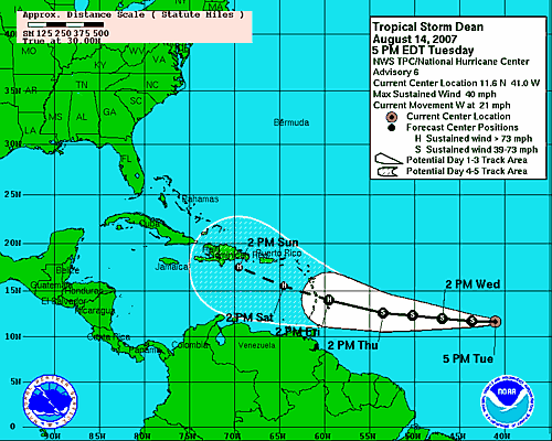
August 1st, 2007---: After a quiet July, with the exception of Tropical Storm Chantal that formed on the last day of the month, things are starting to wake up out in the tropical Atlantic. As of writing this, there is a recon mission underway into Invest 99L which is east of the southern most Leeward Islands, there is another area in interest in the Gulf Of Mexico, and finally....a very healthy looking wave that has recently emerged off the west coast of Africa. Ahh, August is here! This year so far is very different than 2006. First and foremost, there is no El Nino in place this time around, the African Dust which plaged the Atlantic throughout the height of hurricane season in 06' has started to wane, and the Atlantic as a whole is starting to moisten up a bit. Time will tell of course if we'll have something to intercept in the coming weeks, but regardless...I've already started my preparations. Yesterday I picked up a new pair of water shoes, along with a Bell Helmet and a safety mask. All things that are neccesary when intercepting a hurricane. Protecting your eyes and head are of utmost importance. I have also purchased an underwater housing for my camera, so this time around I have a bit more flexibility as to where I can shoot video! More updates to follow as we get further into hurricane season! Be sure to check back often..
June 13th, 2007---: Dave and I completed part two of our storm chasing trip this past Monday. No tornadoes were sighted unfortunately this time around, but we did manage to get on 4 seperate tornado warned storms on June 7th in Missouri! Our last day there was quite eventful as well. As Dave and I headed back towards Denver the night before we were set to fly out, we encountered a cluster of cells near McCook, NE.....lots of photos ops were to be had for the next few hours! All in all, we were happy with the trip, despite the lack of tornadoes. We also were able to hook up with our friends George Kourounis and Mark Robinson. George is in the process of shooting another episode of his tv show "Angry Planet" (www.angryplanet.tv) Dave and I got to be a part of this particular episode, and a blast was had by all! A big thanks to Mark and George for the tons of laughs had on this trip! Be sure to check out my latest photo additions which are now up on my "New Photos" page!
June 5th, 2007---: Dave and I are heading out this evening on Jet Blue to Denver, CO. We would of liked to have flown into a city a bit closer to the target area tomorrow, but all the other airlines were WAY too expensive. So, we'll make some headway later tonight, and then we'll continue on tomorrow morning. Check back for more updates!
June 4th, 2007---: After pondering over the models for a few days now, things are starting to look interesting for the mid/late week period, and possibly into the weekend. So, Dave and I have decided to head back out to the plains tomorrow for Part 2 of our chase trip! We'll be departing New York tomorrow evening and will fly into Denver on Jet Blue where we'll pick up our rental car, and make some headway before finding a place to grab a few hours of sleep. Then, we'll pick it back up on Wednesday morning and will team up with George Kourounis and Mark Robison. Mike Theiss will be joining us as well, it's definitely looking to be a fun day no matter what happens! Right now, Wednesday has a lot of potential, but with storm movement forecast to be around 40kts, keeping up with any storms that do develop will be extremely difficult. More updates to follow!
May 15th, 2007---: Dave and I did the drive back to New York a few days back. Things were looking pretty quiet for the next week or so, and we decided it would be best to head back, and then fly back out and rent a car when the activity picks back up. We're expecting to be out there again within another week or so. More updates to come!! In the meantime, I've posted some pics on our "New Photos" page of the Greensburg, KS tornado aftermath. Dave and I were with Dave Patrick and his wife Kristy doing a damage survey just south of town when we came across some boxes in the middle of a dirt road. It turns out that these boxes were filled with Pop Tarts, about 10 cases of them!! They must of fell off a supply truck, and it was obvious they were meant for the town. We brought the boxes to the check point and were granted full access to the town. Our thoughts go out to all of the residents of Greensburg, seeing the devastation up close will be something I will never forget.
May 8th, 2007---: Not much has taken place out here since the weekend. We chased a few days back in western Oklahoma (May 6th), but all the storms quickly lined out. We were however treated to a great lightning show near Shamrock, TX so no complaints there! Yesterday we targeted the area south of Wichita Falls, TX...but no storms materialized. We're now in Abilene, Tx and it's possible that Dave and I will head back early since it looks like things are going to shut down for quite a while. If we decide to do this, we'll fly back out and rent a car when things pick back up which would most likely be towards the end of the month. I've posted some pics from this past weekend, visit our "New Photos" section and check them out!!
May 6th, 2007---: What a marathon drive that was! Dave and I drove straight from NYC, to Great Bend, KS. where surprisingly, our target area had not changed much from the night before. We met up with George Kourounis, and quickly set up the truck for the chase. Our target storm ended up being the same storm that caused all the damage, and unfortunately...some fatalities in the Greensburg, KS area. We approached the storm from the east on route 54/400, but with it being after dark, we didn't think it would be safe to continue. After hearing the report of a mile wide wedge on the ground, I'm glad we made that decision! We drove back to Pratt where we got one of the last rooms at the Econo Lodge. Later that night, there was in influx of people from Greensburg that were displaced by the storm. From what we understand, no more hotel rooms can be gotten, they're all booked for the next several days in that area.
We awoke the next morning to find that the SPC had issued a High Risk for most of Central Kansas. I can't remember the last time I was out chasing during a high risk day. But, high risk..usually means BUST CHASE! lol....It's almost the kiss of death when you see a high risk, usually storms just end up lining out, and what you're left with is a huge squall line with little tornado potential. Yesterday however, this was not the case. Dave and I started the day in Pratt, KS and as it turned out, Jason Pollite, a good chaser friend of ours was staying at the same motel as us. We hung around in Pratt for several hours gathering data when we finally made the decision to head a bit north and west to try and intercept storms that were firing up to our southwest. The storms were moving at 45 MPH yesterday, so keeping up with them was a very difficult task to say the least! To make a very long story short...lol, Dave and I intercepted several brief tornadoes near the towns of Stafford, KS & Great Bend, KS. Just trying to stay ahead of these things wiped us out. We literally were able to stop for like a minute at the most, before we had to get back on the road again to reposition. That was the story of the day, we were constantly repositioning. No time to set up tripods and whatnot, just shoot video for a minute, and then head on down the road. All in all though, it was a very good day and I will post pictures as soon as I can. Today, there is a moderate risk area out for Central Kansas once again. However, with all the overnight convection....this is bound to affect things, and forecasting today will be difficult. More updates to come!!
May 2nd, 2007---: After pulling our hair out for the past few days trying to decide whether to pull the trigger on this trip now or not, Dave and I have finally made the decision to go for it. As it stands right now, things look great for chasing on Saturday in Kansas, and Sunday, Monday & possibly Tuesday might be decent as well. That along with another trough forecast to move into the plains around the 12th helped make this decision. So what next? Well, tons and tons of preparations have to be completed by tonight. Dave due to a prior engagement cannot be at my place until around 11pm tomorrow evening, so right now it's looking like a midnight tomorrow night departure. We usually do the all night drive anyway, so it's not that big of a deal. But, I will have to stay up all night tonight so I can sleep most of the day tomorrow. This way I'll be good to go for the night driving. Then, on Friday morning when I'm out of gas, Dave can take over. Check back over the coming days for daily updates and pics!!
April 29th, 2007---: As it stands right now, it's possible that Dave and I will be leaving for the plains this coming Friday the 4th. While several forecast models have been doing the old flip flop these past few days, things are looking up for an active period of severe weather starting this coming weekend. There's still plenty of time for things to change, but right now....we're planning for a Friday departure. It's always right around this time of year that our stomach's get tied in knots...lol. Do we go? Do we stay put?, etc, etc, etc. But, that's all part of the total experience. More updates will follow soon!
April 13th, 2007---: Another month has gone by, and still no signs of spring! At least not here in New York City. We're stuck in a nasty pattern as of late, and temperatures remain well below normal for this time of year. But, chase preparations continue regardless! Next weekend I will be taking a trip up to Dave's place to do some maintenence on the hail guards, as well as wiring back up the radios in my truck. Our friend Mark Robinson from Toronto will be meeting up with us as well for this. It's just another reminder that chase season is rapidly approaching. As far as a tentative departure date? Who knows....it's anyone's guess right now. Sometime between May 1st and June 1st...lol. This all will depend on when we see a good pattern setting up for severe weather. More updates coming soon.
March 16th, 2007---: Well it's certainly been a while since this page has been updated. But the time has finally come, our storm chase 2007 plans have now begun! We kicked it off by heading down to the Florida Keys for a small chaser get together from March 2nd to the 5th. Jim Leonard hosted the shin dig, and a good time was had by all. Dave Lewison, along with myself and my girlfriend Cecelia joined Jim at his place for food, laughs, and tons of chaser video! Bill Hark, Mike Theiss, Brad Reiley, Michael Laca, and Chris Kridler along with her husband George were also in attendance. I've posted some pics on my New Photos page, check them out! Oh, and there's one picture in there that might look strange (you'll know it when you see it...lol). Anyway, that is a picture of Dave trying to feed a chicken at the Blue Heaven Bar & Grill in Key West. More chase 2007 updates will be coming soon, so check back often.
August 29th, 2006---: I still can't believe that it's been one year since Hurricane Katrina made landfall along the Gulf Coast. That experience will stay with me the rest of my life, and our prayer's are still with all of those affected by the storm. But in other ways, what a difference a year makes! While many people think that the 2006 tropical season has been slow, for the most part...it's right on track. You can't use 2005 as a guage, this is a more typical year in the tropics. But don't let your guard down, we are now entering the height of hurricane season, and the Atlantic is starting to show signs of activity. Tropical Storm Ernesto is making landfall in South Florida as I type this, and there are several other tropical waves out in the Atlantic that bear watching. There is still no way to know how many, if any systems will make landfall, but we still have a long way to go this season. Dave and I are ready to head out if any hurricanes threaten land, so check back for updates over the coming weeks!
May 23rd, 2006---: May 2006 has certainly been quiet out in the plains, many chasers and tour groups were left with finding other ways to stay sane throughout the past few weeks. Things are starting to pick back up however and who knows what June will hold. For me, I'll start focusing on the upcoming hurricane season which is forecast to be another active one. We shall see....
May 14th, 2006---: Well, our chase trip was pretty much uneventful overall..lol. We got locked into a stagnent pattern that would not let up, and decided to cut our trip short by a few days. Dave and I might head back out there sometime in June if possible to see if we can make up for the lack of storms on this trip.
May 4th, 2006---: Our annual chase trip will begin this Saturday. Final preparations are being made, and right now things look decent for next week. Not super great, but things can change in a heartbeat. Will be posting updates from the road
May 1st, 2006---: The hail shields are complete, antennas are mounted on the truck, etc...May is here and our annual storm chasing trip is just days away. Right now we're planning on leaving this Friday, May 5th. This will depend on how things look later in the week. Check back often as I will be posting updates on this page from the road..
April 18th, 2006---: We have about another 2 1/2 weeks until our chase trip begins! Right now we're planning on a May 5th departure, we'll see how the weather for the following week pans out and that will determine our exact departure date. Tomorrow I am bringing my Xterra in for servicing and then I will start hooking up the CB radio again. I also have re fabricated the headlight hail guards for my truck (the old ones were destroyed in South Plains last year). Dave has put together a nice laptop stand that will go in the truck, and this one has a few shelves in it so we can keep everything organized this time around. The other hail guards are coming along nicely and we will have them completed by April 29th, pretty much just in time!
April 5th, 2006---: I took a trip up to Dave's friend Marc's house this past Saturday to begin work on our new hail guards for my truck. This year the frames will be made out of PVC, and instead of wire mesh, we will be using Lexan. We did get a lot done over the course of the day, took measurements, built some of the frames, re meshed the windshield guard, etc... I will be taking one more trip up there on Saturday April 29th to finish everything up. Dave also fabricated a new laptop/CB/XM Threat System stand for us. Dave rules!!! The weather has been warming up here, and the trees are beginning to bloom...SPRING IS ON THE WAY!!!! About another 5 weeks and we'll be hitting the road.
March 21st, 2006---: Spring is finally here!! Well, it doesn't really feel like it that's for sure. Temps this morning were in the upper 20's! But, the fact that it's officially Spring is good enough for me. And, along with the arrivial of Spring, comes our yearly chase preparations. I've ordered a new CB antenna (the Wilson 5000), along with a new dash mount for my camera, and some external speakers for my CB radio. All of this will be hooked up in the coming weeks as the weather warms up a bit. Then, on April 9th, I will be taking a trip up to Dave's place to start work on our new hail guards. Lots happeneing over the next month so check back for updates!
November 24th, 2005---: And with Thanksgiving upon us, the long winter break from chasing finally arrives. Temperatures are dropping, the cold air is setting in, and even though the tropical season is having a hard time letting go....it's pretty much break time for all the chasers until next spring. See you in 2006!
October 19th, 2005---: And yet another record breaking hurricane in the Atlantic! Hurricane Wilma shattered records this morning when she exploded overnight into a Category 5 monster. She is expected to hit the Yucatan and then recurve and hit South Florida this weekend. Money is tight right now so no more chasing for me this year, but next year I'll hopefully be able to chase at least two canes! For all those chasers going to intercept Wilma, best of luck to all of you! It should be pointed out though that Wilma is expected to weaken a bit before hitting the US. But, this far out it's very tough, if not impossible to predict intensity. So for all those living in South Florida, prepare for the worst, and hope for the best.
September 28th, 2005---: Hurricane Rita battered the Tx/La border with winds of over 100MPH late last Friday night. Dave and I sat this one out, but George Kourounis and Mark Robinson from Canada intercepted Rita in Port Arthur, Tx. Everything went fine until they tried to get out of the area and were blocked by high flood waters and debris blocking the roads. Eventually they made it out of the area, and have made it safely back to Canada. Details of their Rita intercept can be found at George and Mark's websites.
September 21st, 2005---: Dave and I will be sitting this one out. Hurricane Rita right now is a borderline Cat5, and will most likely be classified a Cat5 later today. George Kourounis and Mark Robinson will be chasing Rita however and will be leaving this evening for the Tx. coast. Dave and I could not track down any reasonable airfare, basically nothing under a grand. Tack on a rental car, and spending money, and it gets out of control. Also, there is the possibility of Rita making landfall at night. As it stands right now, New Orleans seems to be in the clear which is very good. Landfall right now appears to be sometime late Friday night, or early Saturday morning south of Houston, Tx. possibily near Port Lavaca which is east of Victoria, Tx. Still though, I'd love to go....but need to start saving the bucks, ya know?. Best of luck to all the chasers that will be intercepting Rita. Below is a satellite shot of Rita taken at 18Z today.
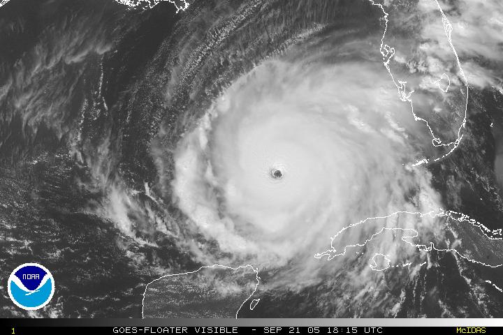
September 1st, 2005---: Let me start off by saying thank you to Mark Robinson and George Kourounis, you guys are great...thanks for everything. Dave Lewison and I flew from NYC to Orlando, Fl. on the evening of August 27th and headed for the Mississippi Gulf Coast. We stopped in Gainesville, Fl around 1am to catch a few hours of sleep before continuing the drive (we knew we wouldn't be sleeping much after that). The next morning we awoke to find that Katrina was now a Category 5 storm with winds of 160MPH. I have to say, we were both nervous about intercepting a storm of this intensity, but decided to continue on. As we made our way west on I-10 we heard that Katrina had strengthened even more with winds now up to 175 MPH!!
We met up briefly with Mike Theiss in Tallahassee, Fl and talked about our plan. Mike was still considering going to New Orleans, while Dave and I planned to stay a bit east of the projected landfall due to the fact that we didn't want to get directly into the path, we just didn't feel comfortable with that. We stopped many times while driving west since we wanted to gas up as much as possible and pick up extra supplies. We did bring 15 gallons of extra gas with us but wanted to keep the tank as full as possible. As we approached the Mobile, Al. area we received word from storm chasers George Kourounis and Mark Robinson that they had found a suitable shelter in Gulfport, MS. It was a parking garage attached to the Hancock Bank on 14th street. This location was about a half mile from the ocean. At first Dave and I didn't feel comfortable with this location but decided to met up with them and see it for ourselves. We arrived in Gulfport around 6pm on the evening of the 28th and looked over this parking garage. Dave and I decided at that point to see if we could find anything better a bit east of Gulfport in the town of Biloxi. We drove there and searched but found nothing suitable at all. We even tried getting into the parking garage of the Imperial Palace, but were turned away by security. At this point we bounced back and fourth several times on what to do. It was really the lesser of two evils, stay further east and hope we find decent shelter, or head back to Gulfport which was closer to projected landfall but we would have better shelter. We decided to head back to Gulfport.
Upon arriving back in Gulfport we checked out the marina, it was really beautiful and we were some of the last people to see that place intact. We met back up with George and Mark and at this point that had some good news for us. Several people were taking shelter in the Hancock Bank that our garage was attached to and told us that if things really got bad, we could take shelter with them in the bank. This made us feel a bit better. With being on the third floor of this place we felt relatively safe from the storm surge, but still had our concerns on how high the water would get. We also got word that this structure survived Camille in 69'. We also spoke to some emergency management folks who gave us their cell phone numbers. So, this is where we would ride out the storm.
None of us got much sleep that night and around 5am the next morning is when things starting picking up. We all started shooting video from down at street level since we knew that soon we would have to hold up in the garage and only the garage. Around sunrise is when all hell started breaking loose, and by 9am we were in the thick of it. Debris was flying by at an incredible rate of speed and roofs all around us were being ripped apart. Part of the bank roof tore off and landed right above us on the fourth floor of this parking garage. The entire place was vibrating and our biggest concern at this point was not being struck by flying debris. The roar was constant, and every few seconds you would hear glass breaking, and roofs coming apart. We could see the surge surrounding our location but thankfully it didn't get higher than a few feet where we were. If you went just a bit south, they were under almost 20 feet of water. The next few hours were spent shooting video, re positioning the cars and basically just trying to not get injured. Small rocks were being blown into our level and smashing out car windows everywhere, thankfully our vehicles didn't sustain any damage, again....we got lucky.
As things calmed down and we ventured outside, it became obvious that Gulfport was in ruins. We surveyed the damage for about 30 minutes before making our way out of the area. At this point we still weren't sure if we'd even be able to get out but decided to try since if we stayed the authorities would put everything in lock down and we'd be stuck for sure. We managed to make our way back to I-10 where for a few miles had to actually drive eastward in the westbound shoulder. We did all make it out and Dave and I drove to Crestview, Fl where we spent the night in the car in a Hampton Inn parking lot. The next morning we drove back to Orlando, Fl and even managed to get there early enough to catch an earlier flight home! Without a doubt we were lucky in several ways during this trip, we all realize that. I am very thankful to be home now and my prayers are with all those affected by Katrina. If anyone reading this can, please make a donation to the Red Cross...these people need all the help they can get.
Below is a five minute video clip of footage I shot in Gulfport during Katrina (20MB Download)
August 30th, 2005---: Dave and I met up with Mark Robinson & George Kourounis and chased Hurricane Katrina. We're currently in Gulfport, Miss. where Katrina caused widespread devastation. More to follow including video clips tomorrow.
August 25th, 2005---: Dave and I are watching and waiting to see what Hurricane Katrina will do over the course of the next 24 hours. Right now Katrina is over southern Florida and will re emerge over the waters of the Gulf tomorrow morning. If things look good for Katrina, then Dave and I will be flying to New Orleans Saturday afternoon. George Kourounis and Mark Robinson will be joining us, and Jim Edds will be on the chase as well. Check back tomorrow for more updates. Still lots that can happen between now and tomorrow night, which is when we'll make our final decision.
August 15th, 2005---: WOW, is all I have to say about yesterday. Over the past few months we haven't really seen anything in the way of severe weather here in the 5 boroughs. But yesterday was blockbuster with 3 rounds of severe storms! It all started around 3pm yesterday when a line of severe storms moved right into Queens, NY. I shot video for The Weather Channel in the area and was treated to a nice lightning show with several strikes hitting within a quarter of a mile from my location. Torrential rains followed and my rain guage recorded .62 inches of rain from that round of storms. Then, around 7pm another line of severe storms moved into our area. More great lightning was to be had as well as more torrential rains. My rain guage recorded 1.26 inches of rain from that round of storms! Then, another line of storms moved in around 10:30 last night. The lightning wasn't as vivid as the storms earlier in the day, but it was still something to see. And from that round of storms, my rain guage recorded .63 inches of rain. I hope we have a few more days like this before our storm season comes to an end. Below is a still image taken from video I shot around 3:45 yesterday afternoon in Queens, NY.
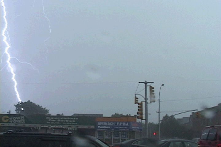
July 29th, 2005---: Dave, Mark and I are all set supply wise for a hurricane chase. Just when that will happen is anyone's guess, but with the way things have been lately in the tropics, we probably won't have to wait long. I picked up two cases of MRE's, so we'll have plenty of food, and I also picked up 20 emergency light sticks (they really came in handy during Hurricane Frances last September). Dave picked up some spare gas cans and some light sticks as well, now we won't have to sweat running out of gas like last year in Daytona Beach, Fl. Right now things are quiet in the tropics after a record breaking July. That lull probably won't last too much longer, so we'll be keeping a close eye on things over the coming weeks.
July 9th, 2005---: Well, it looks like we'll have to sit and watch Dennis make landfall from NYC. I wasn't able to go after this one due to several factors, one of which was that we weren't prepared to chase a hurricane this early in the season. Our supplies will be in place soon, so the next time a hurricane threatens the US....we'll be there. Dennis weakened from a cat 4 to a cat 2 as it passed over Cuba, but definitely has the potential to gather strength now that he's back over the open waters. I'll be nowcasting for several chasers tomorrow as Dennis makes landfall....
June 14th, 2005---: Dave and I flew out of JFK Friday morning and arrived in Denver around 10am local time. We rushed to get our rental car and blasted west and south in the hopes of catching some storms that day in the Texas Panhandle. Everything pretty much turned to crap that day, and the big "outbreak" never materialized. We did however run into some tennis ball sized hail near Boise City, Ok. And almost destroyed the rental on the first day! Dave and I seem to be hail magnets this year for some reason...lol. Anyway, since Friday turned to crap, we met up with Charles Edwards from Cloud 9 Tours in Amarillo, and had a nice dinner at the Olive Garden.
The next morning, after looking at the forecast, we realized that we wouldn't have to go far that day at all. As a matter of fact, we never strayed that far from Amarillo the entire day. Dave and I joined Cloud 9 once again that day and ended up intercepting storms just northeast of Amarillo. This storm was a beautiful LP, with a really nice wall cloud. We stayed on this storm, but worried that storms just to the south would produce tornadoes. THEY DID. Even though we didn't see any tornadoes out of our storm...it was the first time I had ever photographed a nice LP. Everything I've photographed up until now have either been classic supercells, or HP's....so no complaints from me! In all fairness, we did witness what might of been a brief touchdown out of our storm, but this hasn't been confirmed.
The next day would be our last chase day, so we decided to head to Shamrock, Tx on I-40 and pack it in for the night. The next morning, Dave and I realized that our target area had shifted several hundred miles to the south. This was not good since we needed to be back in Denver early Monday morning for our flight home. We headed to Childress, Tx and met up with several other chasers at the Kettle Restaurant (at least I think it was a restaurant..lol), all we knew was that they had wi fi, that was good enough for us. Dave and I were concerned that storms would fire around and just east and south of Lubbock, there was no way we could head that far south, and we knew it. We drove down to Turkey, Tx. where we hung out for a while and watched the sky. Storms would begin to go up, but then die out quickly. Nothing was panning out like we thought. After playing cat and mouse with a few decent looking storms around Memphis, Tx. we decided to start heading back to Denver. Of course storms did fire up east of Lubbock, and the southern most storm ended up producing multiple tornadoes, this was a hard pill for us to swallow, but that's the way it goes sometimes. Hey, if we had the time, we would of been there...but it just wasn't in the cards this time around. All in all though, I had a blast! It was great chasing with Dave again, and I had the chance to get together with some good chaser friends. And....we still came home with some great video! I've posted some video stills on our "New Photos" Page..check it out!
June 9th, 2005---: After pulling our hair out all week trying to decide whether or not to take the plunge and fly out for this weekend, Dave and I decided to go for it. We'll be flying into Denver and will arrive around 10am tomorrow morning. We'll have to really haul it out of Denver and hopefully will make it in time to any target areas. This weekend is looking really active out on the plains, so check back often for updates!
May 28th, 2005---: Right now, Dave and I are keeping an eye on things, if you go by the long range forecast models, things might start looking up for the June 3 to June 5th time frame out on the plains. That's still a ways out, but if this pans out then Dave and I will most likely be taking another trip out to the plains for more chasing! This time, since it will be last minute, we'll fly and then rent a car. More updates to follow!
May 19th, 2005---: The past few days have been spent tending to my Xterra, she's banged up, but still going strong. I've been sanding down certain areas where the paint came off, and should have all this done by tomorrow afternoon. It also seems that it was a good move cutting our chase trip short, the plains have quieted down at least for the time being. Dave and I are still hopeful that we'll be able to head back out for a few days next month, hopefully this will happen. I'll post some pics tomorrow of the repairs done on my Xterra, check back! Below, is a radar image of the storm we were chasing near South Plains, Tx. on May 12th (courtesy of George Kourounis @ www.stormchaser.ca). As you can see, we were in the worst part of the storm when we got trapped by the downed power lines.
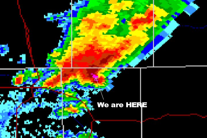
May 16th, 2005---: After a very long drive home, we're finally back here in NYC. We cut our trip a bit short since this coming week didn't look that great out on the plains, and because of the damage that I sustained to my SUV. All is good though, we came out of it fine...and the glass is repaired on my Xterra. Thank god for the hail guards! And an extra special thanks for Dave Lewison and his friend Marc for designing my windshield hail guard. If it wasn't for them, I would of lost more glass. George Kourounis, Charles Edwards and the rest of the Cloud 9 Tour group sustained damage to their vehicles as well, but have repaired the damage and have resumed the tour. Tomorrow I'll be doing some work on the truck, mostly sanding down and repainting the parts where the hail took the paint off. Most of the dents I will leave though, after all...it is a chase vehicle. Even though many chasers were caught in the hail barrage in South Plains, Tx. on May 12th...thankfully everyone made it out ok. One chaser did get glass in his eyes, but he is ok as well. Dave Lewison and I are planning another quick trip out to the plains sometime in June, hopefully this will happen.
May 14th, 2005---: We started heading back to NYC today, with the damage to the truck, we had to cut our trip a bit short. But, I probably will head back out with Dave Lewison sometime in June for a quickie chase...this time we'll fly out and rent...lol. I will however have my truck out on the plains again next year, after all..I bought it with storm chasing in mind. And now with all the dents in it, it REALLY looks like a chase vehicle! This morning we had lunch with Jim Leonard, Gene Moore, Mike Theiss, and the rest of the Cyclone Tours group. We then hit the road and are currently in Lebanon, Missouri. Tomorrow we'll head to Pennsylvania where we'll stay for the night and then take the drive back to NYC on Monday morning. More updates to follow.
May 13th, 2005---: Well, we shot video of a beautiful tornado yesterday near Plainview, Tx...but we got caught in the biggest hail I've ever seen and my truck got demolished. The hail guards did a good job, but I still lost the rear quater panel glass. The dents on the truck are extreme, so I'll have to make a claim with my insurance company which I'm not happy about. I'll post a full chase account in about a week when I return to NYC. If you'd like to view a video clip of what we experience yesterday, click on the link below. It's a 30MB download, WMV Format
May 12th, 2005 South Plains, Tx. Tornado & Hail
May 12th, 2005---: Today (or at the time I am writing this....it was already yesterday) we were chasing in northern Kansas/southern Nebraska....plenty of storms went up, but they were all moving at almost 50 MPH so it was pretty much impossible to catch them. After several frustrating hours we decided it would be best to head south into southwest Kansas to set up for tomorrow. On our way down south, storms fired along the dryline in a line from Liberal to Garden City to Scott City. We intercepted a storm that was heading right for Garden City, Kansas (which is where we were staying tonight). We quickly realized that we weren't going to make it into the Garden City area prior to the storms arrival, so we stopped on 83 just north of the area in a town called Friend. From there we could see the storm, and shot some great lightning video. The storm was now tornado warned and we very carefully made our way south on 83 towards Garden City. The only reason we attempted this after sundown was the fact that we had the Baron Wx Threat System running at all times. We could see the hook move right over downtown Garden City, at this point we were only about 3 miles north of it. Upon entering the town, we quickly realized that there was no damage, and no tornado was sighted. We did hear reports of a large tornado near Ulysees, Kansas...but this has not been confirmed as of yet. Well, it's late...and we have more chasing to do tomorrow in the eastern Texas Panhandle, so it's time to get some much needed sleep. We witnessed several funnel clouds in the area, as well as some great storm structure, lightning, and screaming outflow winds that we got caught in near the town of Central City.
May 9th, 2005---: Today was a down day, so we did a bit of sightseeing. We once again stopped by the world's largest ball of twine in Cawker City, Kansas...and met up with Cloud 9 tours. We decided to stop for the evening in Kearney, Nebraska (where we filmed the tornado just the other day) and all went out to eat at a great steakhouse, the name slips my mind right now. This place was insane! They give you tons and tons of peanuts in a bucket and allow you to throw the shells on the floor, we spent most of the time throwing them at eachother....it was a blast! Tomorrow we're targeting an area from North Platte, Nebraska eastward. We'll see how things pan out! Hopefully we'll see some more great storms over the next two days! The pictures below were taken on May 7th just south of Fullerton, Nebraska (Courtesy of Dave Lewison) what a great light show we had that night! You can click on the thumbnails for the larger version.
|
|
|
May 8th, 2005---: I have to say, the past two days have been great out here! Yesterday we started out the day in Colby, Kansas. Things were looking pretty good for the I-80 corridor in Nebraska, especially around the Kearney, Ne. area. So that's where we headed and right as we got there towers started going up. We bounced back and fourth for a bit and finally targeted a storm near Holdridge, Ne. The storm was heading right for I-80 and we intercepted it in the Kearney area. As we positioned ourselves around the south side, a large tornado came into view. We were only able to shoot video of it for about a minute before we lost sight of it, but it was there...and it was big! After playing catch up for a few hours we decided to call it a day and shoot some lightning video. What a light show it was! Hundreds of flashes and bolts were generated by this storm.
Today, we started out in Grand Island, Ne. and targeted northeast Kansas. We headed down I-80 towards Lincoln and then dropped south. Once again, storms started going up early and we intercepted a cluster of storms near Washington, Kansas. The storm we were on was severe warned, but not tornado warned like the storms we intercepted yesterday in Nebraska. None the less, were were treated to some intense hail, lightning, a nice funnel cloud, and one of the best shelf clouds that I've ever seen! We also had a bolt of lightning hit a field a few hundred feet away as were were driving through the storm. No complaints at all! Tomorrow is looking like a down day so we'll do some sight seeing. But we're in for what could be another active week coming up. Check back for updates!
May 8th, 2005---: Tornado captured near Kearney, Nebraska yesterday evening....
May 7th, 2005---: After a long chase day yesterday, playing catch up with storms...we managed to see a few bolts of lightning..that was about it...lol. But we're out here on the plains, so all is good. Even though we really didn't see anything yesterday. We still have a long way to go, and today we have some decent prospects in either north central Kansas, or possibly Nebraska. We're still deciding on where to go today, but hopefully we'll see some storms today. Right now we're in Colby, Kansas...
May 4th, 2005---: Dave Lewison, Peter Ventre and myself departed from NYC yesterday evening and didn't stop driving until 6pm tonight! We're staying the night in Lebanon, Missouri and we're all looking forward to some much needed sleep. We did manage to catch an hour of sleep here and there, but overall...we're completely wiped out. Most motels now offer high speed internet, so I'll be updating this page on a daily basis. Tomorrow we'll make our way to Oklahoma City and decide then whether we'll spend the night there, or continue on a bit further west. Friday is looking promising, but the weekend is looking even better as it stands right now. This can change of course, but we'll know more tomorrow morning when we look at some updated data. Now it's time to pass out!
May 3rd, 2005---: Our annual storm chasing trip is finally here! Dave Lewison, Peter Ventre and myself will be heading out of NYC this evening around 7pm. Be sure to check back every few days for updates from the Road!
April 29th, 2005---: After looking at all the forecast models concerning the next week out on the plains, Pete, Dave and I have decided to hold off on leaving until Tuesday, May 3rd. As it stands right now, things start to look more promising towards the end of next week. More updates to follow!
April 26th, 2005---: Our chase trip is just days away! Right now, things still look good for a Saturday morning departure. The models are still pointing towards an active first week of May. The plan right now is for Dave Lewison to meet me here at my house in Queens, NY Saturday morning around 8:30am. Pete will already be here and we'll pack up the truck and head on out. We'll be meeting up with Mark Robinson and Dave Sills somewhere in Indiana (most likely). Since we won't meet up until late Saturday night, we'll rest for the night and then make the drive to Oklahoma City Sunday morning. This of course is all subject to change, but that's the plan right now. More updates to follow over the coming days.
April 24th, 2005---: Dave, Pete and I attended a Skywarn Spotters class last Thursday in Putnam County, NY and while there, installed the windshield hail guard on my Xterra! Click Here to view pictures showing the entire process from start to finish (courtesy of Dave Lewison). And, our chase vacation is only a few days away!!! Right now, things are looking pretty decent for the first week of May. That of course could change over the coming days, but we're all remaining optimistic. More updates to follow.
April 17th, 2005---: Dave and Marc have completed the hail guard that will go on the roof of my truck! This coming Thursday, Peter Ventre and myself will be meeting Dave in Upstate NY for a Skywarn Spotter Class, we'll be meeting up a bit early to test fit the windshield hail guard. More pics will be posted this coming weekend! Our chase vacation is about two weeks away!
April 9th, 2005---: Brian and I took a trip to Upstate NY today to visit Dave and his friend Marc, and to work on the construction of the windshield hail guard that will be going on my truck. Brian and I tapped holes, did some drilling, and basically helped out in any way that we could. Marc did all the welding, and spent the better part of the afternoon welding pieces of the frame together, cutting metal and taking measurements. Dave was taking measurements, drilling, tapping holes, etc....It was a great day, and all of us worked hard and had a blast! Dave and Marc will be finishing up on the hail guard over the next week or so and it will be ready in plenty of time for this years chase vacation, which is coming up in a few weeks!
March 7th, 2005---: Less than two months to go before our chase trip! This pattern that we've been in is not good at all...thankfully we have a decent amount of time left for things to change. If this recent blocking pattern were to take place in late April, that would cause a problem! Also, Dave, Pete and I are much more flexible this year with our chase vacation. Right now we're planning to leave on or around April 30th, but if the first week of May looks calm, we'll hold off for a few days until things pick back up. Let the planning begin!! I've been doing some maintenence work on my hail guards, and Dave has been building the guard for my windshield. On March 26th, we'll be taking a trip up to Dave's house to finish up on the guard...I'll take tons of pics and post them on the site.
February 7th, 2005---: Over the past month Dave Lewison and I have been tossing around different ideas as far as the windshield hail guard is concerned. I have to say that Dave is really the one with all the great ideas, and has a firm knowledge of how to construct this. Last year, I fabricated hail guards for all my side and back windows, but got stuck trying to figure out how to make one for my windshield. This year, thanks to some helpful info for other chasers such as Eric Nguyen...we were able to come up with some good designs, and will begin work within the next few weeks. I will post pictures as soon as we begin.
January 6th, 2005---: Dave Lewison and I are currently coming up with ideas for fabricating a hail guard for the windshield of my Xterra. Having protection for the windshield will be a big load off our minds this upcoming chase season. More to follow......
December 21st, 2004---: I've done some revamping to PSPhoto. Instead of lumping my NYC weather observations together with my storm chase accounts, I've now separated them into two different pages. This page will be updated on a regular basis starting in February 2005 when I begin to prepare for the 2005 chase season. I will be posting modifications done to my chase vehicle, as well as various plans for the upcoming season.
September 25th, 2004---: Hurricane Jeanne is now a cat 3 storm and heading right for the east coast of Florida. Four land falling hurricanes in the last 45 days, WOW....you don't see that very often. Several chasers will be out chasing this one as well, I will not be one of them (no money left in the chasing fund for this year). Landfall will most likely be in the predawn hours of Sunday, and there is the possibility of more strengthening.
September 23rd, 2004---: It's been non stop this year, and Florida is once again under the gun for a direct strike from another hurricane. Hurricane Jeanne started moving westward today and is set to strike the Florida east coast within the next few days. The potential landfall looks to be very close to where Frances made landfall just a few weeks back. Right now, Jeanne is a cat 2 hurricane, but there is the potential for Jeanne to strengthen into a major hurricane before landfall. In a normal year, I usually have one shot at chasing a hurricane, this year however I would of had my pick..all though if I would of chased all of them I would most certainly be broke by now. As far as our weather here in NYC, it's been warm and sunny...just the way I like it. If this pattern could hold throughout the winter that would be great!
September 17th, 2004---: The Remnants of Hurricane Ivan are slowly moving into the northeast. A flood watch is in effect for our area and the rains should begin moving into the area this evening. Periods of heavy rain will hit the area overnight and then all the rain should taper off during the afternoon tomorrow. A video clip will be posted tomorrow.
September 15th, 2004---: Hurricane Ivan is heading right for the Mobile/New Orleans area at this time and he looks nasty!! Ivan will make landfall tonight, and there are several chasers in the area. Jim Edds being one of them, who I just spoke to.
September 12th, 2004---: Hurricane Ivan is currently passing the Cayman Islands and possibly has the panhandle of Florida in it's sights. Florida has definitely had enough with Ivan being the third hurricane within the last 30 days to threaten that area. I have to sit this one out, don't have the money right now to afford another chase. Even though Ivan is currently a strong cat 4, borderline cat 5...the thinking right now is that Ivan will weaken a bit before making landfall somewhere along the gulf coast.
September 8th, 2004---: Holy cow, so many things happened during our trip down to Florida to chase Hurricane Frances I don't even know where to start. This is a very detailed account so get ready for a good long read! Ok, here we go.....The trip started on September 1st when Dave Lewison made the drive down from Upstate NY and met me at my house here in Queens, NY. We headed out and drove right down I-95 and met up with George Kourounis and Mark Robinson just south of Washington, DC. By the time we got there it was now about 1:30 in the morning. By the next morning we had made it to Benson, NC where we stopped for gas and some breakfast. Right after getting some gas as we were pulling out of the gas station this other GMC truck was coming into the gas station. Dave and I noticed that he wasn't paying attention to where he was driving as his head was turned, he was looking at George's truck and we layed on the horn for a good 3 seconds to warn him that he was heading straight for us...he never turned around. Next thing I knew he slammed right into the front of my truck and that's when I flipped out!
Thankfully I had a hugh brush guard on the front of my truck, most of the impact was absorbed by that, but I still has some considerable cosmetic damage. His truck however was messed up really bad. We had to dismantle the brush guard and store it in my back seat since it was pressed up against my hood now. After dealing with the police and insurance, Dave and I decided to continue on since there was no engine damage. A big thank you to George, Mark and Dave for helping me with everything, I would of really been screwed without them. Anyway, we continued heading down I-95 and finally made it to the Florida border during the late afternoon and stopped again to shoot some video of the massive traffic heading north on 95. I have never seen so many cars!!!! At around 10pm we pulled into Juno Beach, Fl. where we met up with Jim Edds and Mark Rackley. By this point all of us had been up for well over 35 hours and we were dead on our feet so we checked some data and hit the beds.
The next morning we headed over to the beach to shoot some heavy surf video. We had to be out of the area by noon since there was a mandatory evacuation in effect and decided to make a quick stop at a local grocery store to pick up some last minute supplies. After picking up our supplies we drove a bit further north to Ft. Pierce where we were lucky enough to find available rooms at the Crossroads Inn. Once we were all checked in, we all went out and shot some pre Frances video. Most of the stores and homes in the area were already boarded up and at this point very few gas stations were open so we made sure both our vehicles were totally filled up (this still wasn't enough we'd later find out).
The next morning is when things started picking up and we headed over to the barrier islands to get some surge video. By the time we got there the winds were already tropical storm force and we got some great video down by the marina of boats being tossed about in the water, palm trees bending in the wind, and tons of debris on the roads. Frances was really taking her time coming in, at this point the storm was just about stationary so this gave us time to go to many locations to shoot video including the town of Stuart which was a bit south of Ft. Pierce. While on US1 heading towards Stuart, we noticed a Buick/GMC sign that was dangling right over a bunch of new cars and hung out for a while to see what would happen. It didn't take long for the large sign to snap off it's post and fall right on one of the new cars. After that, we pressed on to gather more video. Upon arriving in Stuart we witnessed many trees and power lines down and stopped to get some pics, realizing at this point that Frances wasn't even here yet!
After many hours of getting soaking wet, we decided to head back to the hotel to dry off a bit and eat some dinner (we made sure to bring enough food with us so we wouldn't go hungry). We all agreed that it was best to stay at the hotel for the rest of the night since we were all down to a half tank of gas and it would be getting dark soon. This is where things started getting bad.
Scott Blair has stopped by our hotel and told us that there was one gas station open on the turnpike about 8 miles south of our location so Dave and Mark went to track this gas station down while George and I waited at the hotel. When Scott told us that the gas station was on the turnpike, we assumed he meant I-95...this was wrong and Dave and Mark drove around for quite a while trying to find a gas station that wasn't there. Scott had meant the Florida Turnpike (being from NYC, when we hear the word turnpike we think of the Jersey Turnpike). It was a stupid misunderstanding that almost got Dave and Mark in big trouble. While on their way back to the hotel Frances decided to start moving again and Dave and Mark were now driving right into the western eyewall. Driving condition went downhill super fast and George and I were really worried back at the hotel, constantly calling them to make sure they were all right. At this point it was now dark and we could see power transformers exploding in the distance. Around 8pm Dave and Mark finally made it back to the hotel, shaken up but unharmed.
Frances seemed to be intensifying right as she was making landfall, still moving at a snails pace. Now we were in the hurricane force winds big time!! We couldn't see anything at all since all the power was out but you could hear things breaking all around. We went up to a corridor on the second floor that gave us great shelter from the hurricane and spent the next few hours shooting video of power transformers exploding. There were several gusts that we experienced that must of topped the 100 MPH mark...it was amazing!!!! Finally at around 2am we decided to get some sleep since the eyewall was now moving over us. Since Frances was moving so slow, the eye lasted for many hours and we didn't experience the eastern eyewall until the next morning!
We all got up at around 7am on Monday, September 6th and at this point things were still relatively calm outside, but that didn't last very long. At around 7:30am the eastern eyewall moved in and once again we had our fill of hurricane force winds to deal with. We shot video for the next few hours and finally at around noon, decided to head on out to get some damage video and then head home. Once again, we ran into more problems.
We both had about a half of tank of gas left so we figured that we would be able to get far enough north to find a gas station open, we couldn't of been more wrong. We drove, and drove, and drove and finally as we were approaching Daytona Beach we realized that it was hopeless and stopped at a really nasty hotel called the Host Inn to hopefully find a room since at this point we were down to fumes. Thankfully they did have rooms available, but we feared for our lives staying at this place (and the hurricane had nothing to do with our fears, let me put it that way). While getting some things out of the truck, Mark was propositioned by a hooker..lol! That was one of the lighter moments of that evening at the Host Inn.
Anyway, we started calling around to see if there were any gas stations in the area that were open and had gas left and thought we had found one in St. Augustine. I had spoke to someone on the phone who said that they did have gas, so we figured that was our only hope. George and Mark had more gas than I did so they opted to do the 40 mile drive to St. Augustine (keep in mind, at this point the weather conditions were still horrible outside). If they were able to get gas there, then they would fill up the reserve tanks and bring them back for us to use. Then we would all head back north and fill up. About 30 minutes after George and Mark left we called again just to confirm that they still had gas. It turns out that the idiot that I spoke to thought I was one of their neighbors asking if they still had gas in their stove!!! What else could go wrong!!!! We immediately called George and Mark and told them to turn around and head back to the hotel. At this point George and Mark were as low on gas as we were so we were all stuck there for the night. We ate the rest of the food that we brought with us and then went to bed. To charge our phones and laptops, Dave rigged a spare car battery that I had brought just in case. It looked like something right out of McGuyver.
The next morning things finally started calming down weatherwise. We figured our best bet would be to drive into the heart of Daytona Beach and see what the gas situation was (we were also so low on gas that we could only make it a few miles before we would run out completely). While packing up the cars Mark noticed that George's truck had a flat...here we go again! But this wasn't too much of a set back since George had a full size spare. Once that was taken care of we hit the road and stopped at a Hess station right by I-95 and asked the lady what the situation was. She said to us that they did have gas, but no power. We decided that the only thing we could do was get our spots right next to the pumps and wait. And wait is what we did! We sat there for about 5 hours before power was restored and we were finally able to gas up and get the hell out of Daytona! That part of our trip was strangely fun though. We got to meet all kinds of people and even got to eat at a restaurant next door, finally....a decent meal!
From there it was a 23 hour drive back to NYC for Dave and I, and an even longer drive for George and Mark who were going back to Toronto!. What a chase! I slept like a rock last night and I'm sure it will take all of us a good week to fully recover from this experience. One thing we learned from this whole experience is MAKE SURE TO BRING PLENTY OF EXTRA GAS! Click on the pic below to view a video clip of Frances (19MB Download)

August 30th, 2004---: Frances is still heading westward over the Atlantic and slowly approaching the northern Leeward Islands. Frances will most likely miss the islands to the north, but some of the outer bands will likely affect that region later today and tonight. Dave Lewison and I are gathering supplies for the chase. Today I picked up some canned food, bottled water and some other essentials. George Kourounis and Mark Robinson will also be joing us for the chase, and we'll be meeting up with Jim Edds as well. The track is still very uncertain, so we'll just have to keep a close eye on the storm over the next few days. Right now we're planning on leaving either Wednesday evening or Thursday. Below is a satellite shot of Frances taken this afternoon.
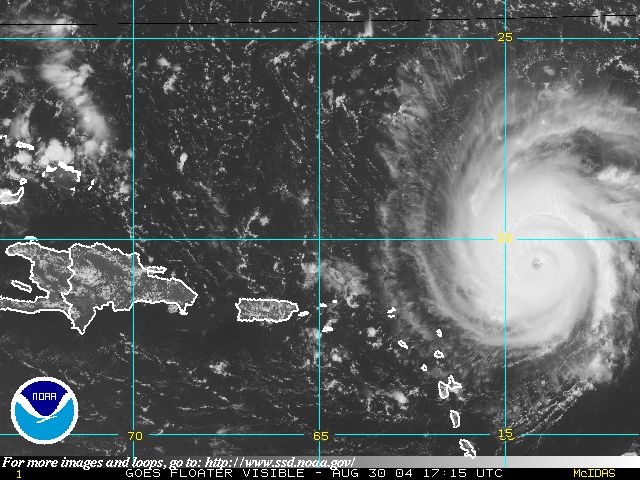
August 29th, 2004---: Dave Lewison and I met today in Manhattan and took a trip to B&H Photo so Dave could pick up some supplies for our possible Hurricane Frances chase this week. Right now Frances is a Cat 4 storm and the current forecast could bring Frances to the east coast somewhere between Florida and the Carolina's by next weekend. I've been making some preparations as well and we'll be ready to leave mid week if need be. There is still a lot of uncertainty on where Frances could make landfall, but right now it looks like Florida....that of course could change. Below is a satellite photo of Frances taken this afternoon. More updates tomorrow!
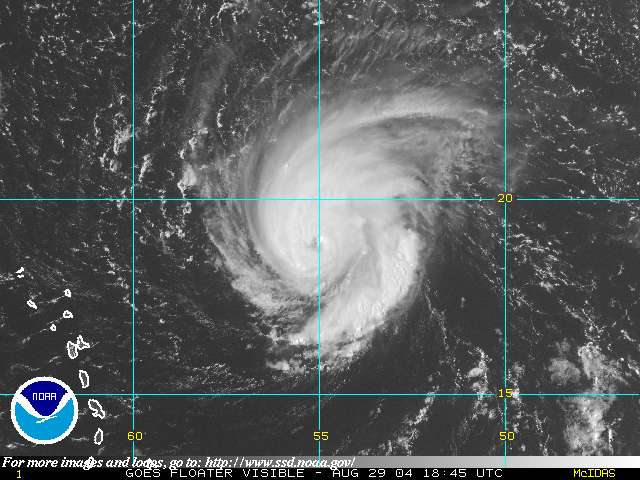
August 14th, 2004---: Well, the stories that I've been hearing from people that were in the Punta Gorda area yesterday are flat out scary! I was nowcasting for Jim Edds, and as he was pulling into the Punta Gorda area was when things started to go downhill rapidly. I didn't hear from him for about another two hours. When we spoke again, he told me that he sustained major damage to his car, broken glass was everywhere and he barely made it back home to the Florida Keys last night. He told me how everything just went crazy and roofs were flying everywhere. Thankfully all the chasers that were in the area made it out all right, that's the important thing. Unfortunately, there are reports coming out of several people that were killed in a mobile home park in that same town. The storm took a turn to the right and slammed right into Charlotte Harbor giving residents there no time to get out. Granted evacuations were ordered, but a lot of people in that area had never experienced a major hurricane, and also thought that it was going to head more north towards the Tampa area. Below is a radar loop of Charley as he begins to make a right turn towards Charlotte Harbor. To view video clips from Jim Edds and his chase partner Mark Rackley visit Extreme Storms
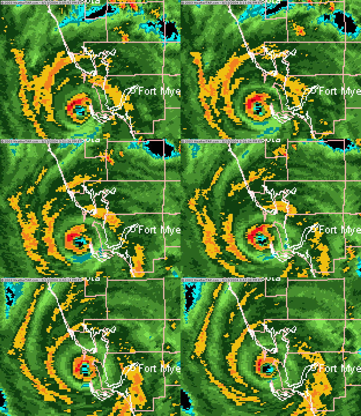
August 12th, 2004---: Hurricane Charley is gaining even more strength (winds are up to 90MPH) and is now heading towards the west coast of Florida, possibly making landfall around the Tampa area. I'm upset I have to miss this one, but when you have a long drive like that, you need to get on the road as soon as possible. In our case, we just couldn't get it together in time. Jim Edds, Jim Leonard and Chris Kridler will all be chasing Charley since they all live in Florida and didn't have long to drive to get into position. Good luck to all of them! Below is a satellite shot of Charley taken around mid day. Note the eye beginning to form!
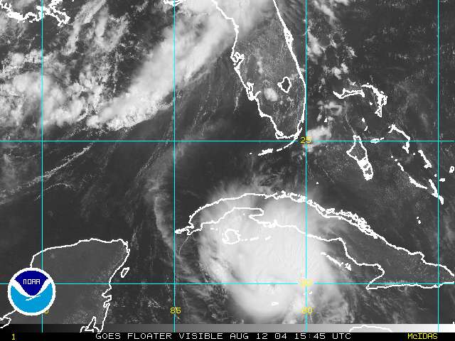
August 11th, 2004---: Hurricane Charley is currently heading towards the Florida Keys. Dave Lewison and I decided against making the long trip down to Florida due to the fact that Charley was moving at a high rate of speed for the past few days, and we just couldn't make it down there in time. Oh well, there's always next time, right? Charley has maximum sustained winds of 75 MPH, but some strengthening is forecast over the next 24 hours.
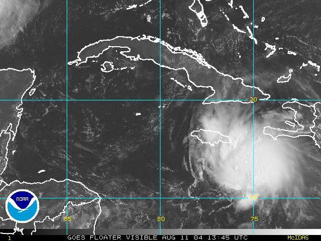
August 10th, 2004---: Tropical Storm Charley is gaining strength in the Atlantic and may affect the Gulf Coast early next week. Dave Lewison and I are getting set in the event we have to head out for the long drive down there. As it stands right now the storm is forecast to become a hurricane and possibly enter the gulf as a strong cat 2 or possibly a cat 3. Below is a satellite pic of Charlie taken late this evening.
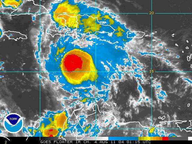
May 21st, 2004---: I received an email today from someone that lives in Attica, Ks. He informed me that there were two people in fact in the house at the time it was hit by the tornado. We were told while we were there that the house was unoccupied, but it's looking like this in not the case. Thankfully they weren't injured, they had taken shelter in the basement.
May 15th, 2004---: Ok, well this is the first time that I've had time to write up a chase account of what happened on May 12th so here it goes. The day started in Colby, Kansas where Dave Lewison, Chris Kridler, Peter Ventre, Mark Robinson, Dave Sills, Sarah Scriver and myself started pulling up weather data for that day. We felt pretty confident that storms would fire in south central Kansas later that day but we didn't expect a significant tornado threat at all. Shear was marginal and to be honest, we weren't really that excited at all. Our initial target was Dodge City, Ks. so we headed down highway 81 and stopped in the town of Scott City to get some more weather data. We managed to find a wi fi hotspot at a local gas station which was great! After checking data we felt that we needed to head towards the town of Meade, Ks. which was west of Medicine Lodge. Upon arriving in Meade we stopped again at a local gas station where many other chasers we gathering and pulled up some more weather data. I have to be honest, I had it in my head that it was going to be another bust day (we had so many of them over the trip). At around 5pm we noticed towers going up to our east, these towers were in their infancy stage but were looking really good so we jumped in our cars and headed east on highway 160 towards Medicine Lodge. Ron Gravelle and Jack Kertzie we also chasing that day in the area and I received several calls from that that the area around Medicine Lodge was looking better and better so we continued on highway 160. At this time the towers were looking really good and a supercell was definitely forming to our east. We rolled video as the storms were developing and as we got closer we started hearing reports that more storms were going up just to the south. Upon arriving in the Medicine Lodge area we pulled off the road and started shooting a developing wall cloud to our north. It wasn't long after that we started hearing reports coming over the radio that there was a tornado on the ground, I looked around but couldn't see it at first...and then as I turned to look east, there it was!!! It was a nice elephant trunk but the contrast was pretty bad, we started rolling video and at this point I was really excited!!! Mark Robinson, Dave Sills and Sarah Scriver had hung back a bit to view the tornado from a scenic pulloff on Highway 160. After that tornado dissapated, we figured ok, that's pretty much it so let's shoot some lightning video...I had no idea that this was only the beginning. We headed down 160 through Medicine Lodge and towards the town of Attica where upon entering the town we heard the tornado sirens sounding. As we got to the east side of town we saw rapid rotation just to our south and pulled off the highway about a quarter mile outside of Attica.
Dust started spinning up on the ground and we jumped out of our cars and started rolling video. Baseball sized hail was falling in the area (got some nice dents on my Xterra)so we had to be careful but at this point we knew a large tornado was forming just to our south about an 8th of a mile away. It was a bit too close and we were all a bit nervous but we felt confident that we could get out of the way in time since the tornado wasn't moving that fast at the time. As the tornado intensified we realized that it was heading towards us so we jumped back in our cars and drove about another quarter of a mile up highway 160 and pulled over again. Now the tornado was about an 8th of a mile wide and heading north towards highway 160 about a quarter of a mile behind us. Dave Lewison and Chris Kridler were in front of Pete and I and we all jumped out of our cars and started shooting video again. Dave and I set up our tripods as fast as possible and as I zoomed in I could see the tornado was about to cross highway 160..I didn't see the house there at first but as the shingles started to rip off I now saw that there was a house directly in the path of the tornado and were were all horrified. All we could think of was that there was a family in there in grave danger and that's when the tornado completely ripped the house apart. It was the most disturbing thing I have ever seen in my life and we got on our radios and called in the report asap. Dave Lewison called his nowcaster Jason, and Jason called the Harper County police and informed them that a house was just hit by the tornado on the east side of town. Many other storm spotters were calling in reports as well and I really believe that if it wasn't for all of them, Attica wouldn't of had sufficient warning. Thankfully as it turns out, it was a home under construction and there was no one there at the time...that was a hugh relief for all of us.
It didn't end there though, there was another tornado forming to the east so we headed up 160 another few miles and that's when we noticed the third tornado forming off to our south. Keep in mind, at this time large hail was falling here and there and were trying our best to get out of the area as fast as possible but 160 only went east so we had no choice but to head further down the road, heading back towards the west wouldn't of been a good idea since we would of been decimated by very large hail. We all pulled off and shot video of the third tornado for a while which was beautiful!! It was over open land too which was great! As we pulled back onto 160 to try once again to get out of the path of this storm we had the scare of our lives.
Another tornado was forming right on highway 160 in front of us...now we thought we were in real trouble. I have to admit, Pete and I got pretty scared and I know Dave and Chris felt the same way but thankfully the satellite vorticy moved south into the field and we nailed the gas and after dodging more large hail we finally got out of the path and set up our cameras to shoot some amazing lightning. All in all we had an amazing chase day, that's for sure. We didn't intentionally put ourselves in the path but unfortunately the road options weren't that great but we did manage to get out safely. Dave and Chris deserve the credit for that, without them Pete and I would of been super confused on how to get out of there since I was fiddling with two cameras and Pete was focusing on the driving, I should of been paying more attention to navagation. Thanks Chris and Dave! And thanks to Mark Robinson, Dave Sills and Sarah Scriver. We had a blast with all of you and can't wait to meet up again. And to end it all, any chase like this that ends with no one injured or killed is a very good day.
May 12th, 2004---: WOW, is all I have to say about today. We filmed four tornadoes around Attica, Ks. today. One crossed the road about a half mile behind us and destroyed a house...thank god no one was there at the time. Tomorrow is looking to be another active day. I'll post a full chase account in the next day or so.
May 7th, 2004---: Well after a week of nothing but sunny skies and bust days because of the cap, things are finally starting to look up for the coming week. Tomorrow Pete, Brian and I have to start heading back down to Oklahoma City since Brian has to catch a flight out early on Sunday morning. We're currently in Blaire, Nebraska and there is the slight chance of some storms later on tonight (all though I'm not holding my breath). As far as next week is concerned, I think it will go back to a more active pattern and hopefully we'll see some good storms. Either way, we're having a blast! Many more updates to follow.
May 5th, 2004---: We're here in Des Moines, Iowa setting up for some potential storm action tomorrow. We stayed in Concordia, Ks. last night and did the 7 hour drive to Des Moines today. Thing look pretty good for tomorrow and better for Friday so hopefully the dry spell out here is coming to an end. Check back for more updates!
May 2nd, 2004---: Well we're here in Salina, Ks. and there's not much going on right now. We've hooked up with some other chasers and right now we're just doing the sightseeing thing until things pick back up...still got a long way to go. The models are looking better and better as far as next week is concerned and I have the feeling that things will start turning around in about a week. I'll update again in a day or two. Tomorrow we're going to check out the world's largest ball of twine (hey, it's what you do on the down days!).
April 27th, 2004---: Our annual storm chasing trip is just 3 days away! Granted the first week out there doesn't look that good right now, but hopefully things will start to look up. I'll be picking up my friends Brian and Pete Friday evening and then we hit the road bound for St. Louis. I am taking the first shift and will drive all night. After that Brian or Pete will take over and I'll try and catch up on some sleep in the back seat. We'll be meeting up with Mark Robinson in St. Louis Saturday evening. Mark will be riding with some of his friends and from there we'll figure out where to go. We'll probably head down towards Oklahoma City at some point on Sunday and meet up with some of the other chasers (Dave Lewison, Jim Leonard, etc.) Ron Gravelle and Jack Kertzie will be meeting up with us later on in the week. I'll be posting updates from the road so check back early in the week.
April 5th, 2004---: Well, it sure doesn't feel like spring here in NYC. Temps were in the 40's today with strong gusty winds. The rest of the week doesn't look much warmer either..WHERE IS SPRING!!!!!??? Anyway, I've completed the hail guards for my headlights.
April 2nd, 2004---: I'm in the process of fabricating some hail guards for my Xterra. A hail guard for my windshield is a bit too difficult to design (and more expensive since I'd have to get thicker wire mesh) so I'm going without one. All the other windows, as well as the headlights and tail lights will be covered so I guess that will have to do. At least most of the glass will be protected.
March 30th, 2004---: I've just installed a Jotto Desk in my Xterra and my next project is fabricating hail guards. I should have all my supplies by midweek and then I can get started. One month and counting until our chase trip!!!
March 22nd, 2004---: With the cold weather here in NYC over the next few days I won't be doing anything with my Xterra today, but temps by the weekend are expected to warm so I'm hoping to get some work done then. I have my Jotto Desk on order as well as some wire mesh that I am going to use to fabricate some hail guards for the truck. I should have everthing over the next week and then I can get started. The hail guards will be the hardest to fabricate but if we happen to get into some big hail out in the midwest in May, I don't want to lose my glass. I will be fabricating a screen for the windshield, the side windows (except the passenger and drivers side windows) and the back window. Thankfully, some of my friends will be helping me with this project. Pictures will be posted as soon as we get started.
March 1st, 2004---: Today we saw temps in the low 60's here in New York City so I decided it was time to start preparing my Nissan Xterra for this years chase trip. I installed a Uniden CB radio along with a Tripp-Lite power inverter. I attached a 6 plug Belkin power strip to the power inverter so I am able to charge my camera batteries, run my laptop and charge my cellphone right from the truck. Many chasers do the same thing so I know I'm not doing anything new and exciting but now that I finally own my own truck it's great fun setting all this stuff up! I tested everything out and it all works which is a major plus. I went with the 375 watt power inverter so I have to be careful not to have too many things going at once but I will only be running one or two things at a time so I should be all right. Next on my list of things to get is a Jotto Desk for my laptop. I should have that by late in the month and will post more pics when I get that going.
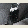 |
 |
 |
 |
 |